|
search place name
|
||
Bayt as Subā‘ī (Yemen)Bayt as Subā‘ī is a town in Yemen. An overview map of the region around Bayt as Subā‘ī is displayed below.
regional and 3d topo map of Bayt as Subā‘ī, Yemen ::
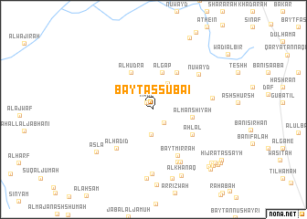
Nearby towns ::
Ḩaql (1.2km north west) //
Shamḩaz (2.1km south east) //
Ghawl aş Şarrāq (3.1km south) //
Al Jiyāʼ (3.6km north east) //
Al Gap (4.7km north) //
Al Manshīyah (4.7km east) //
Al Hudra (5.3km north west) //
Bayt al Gire (5.3km north east) //
Ḩamrāʼ (5.3km north east) //
Aḩlāl (5.5km south east) //
Bayt Mirrah (6.4km south east) //
Al Ḩadīd (6.4km south west) //
Nuwayd (6.9km north east) //
Al Ḩarf (7.0km south east) //
Al Qurayyah (7.2km south east) //
‘Āʼithayn (7.1km east) //
Al Masāwir (7.9km south) //
Bayt aḑ Ḑabyānī (8.4km south) //
Aslā‘ (8.5km south west) //
Thawbar (8.7km south) //
Al Khanaq (8.8km south) //
Banī Miḩann (9.5km south east) //
Al Kharābah (9.5km south east) //
Al Maḩqarī (9.7km north east) //
Banī Sanad (9.8km south east) //
Aş Şayḩ (9.8km south east) //
Banī Şabir (10.0km south east) //
Hijrat aş Şayḩ (10.1km south east) //
Al Qawāzi‘ah (10.2km south east) //
[all distances 'as the bird flies' and approximate] 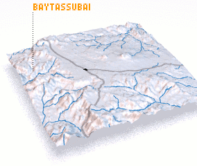 Places with similar names to Bayt as Subā‘ī, Yemen ::
// Betsy Bay (BS)
// Boutazab (CG)
// Boutazab (CG)
// Bettyʼs Bay (ZA)
// Bidoizeba (LR)
// Batey Seibo (DO)
// Bayt az Zāb (YE)
Disclaimer :: Information on this page comes without warranty of any kind |
||
|
Where is Bayt as Subā‘ī? Elevation and coordinates ::
Latitude (lat): 14°52'32"N Longitude (lon): 44°8'27"E
Elevation (approx.): 1719m (map arrows pan, magnifying glasses zoom) |
||
|
Visiting Bayt as Subā‘ī? Hotel/Accommodation ::
Book a hotel in Bayt as Subā‘ī Travel Guide ::
Buy a travel guide for Yemen rental cars ::
car rental offers GPS waypoint ::
download a GPX waypoint (PoI) of Bayt as Subā‘ī for your GPS receiver
|
||