|
search place name
|
||
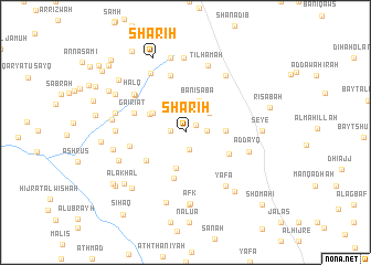
Shāriḩ (Yemen)Shāriḩ is a town in Yemen. An overview map of the region around Shāriḩ is displayed below.
regional and 3d topo map of Shāriḩ, Yemen ::
Nearby towns ::
Banī Khuḑayr (1.2km north east) //
Al Arbah (1.4km west) //
Al Gadd (1.7km south) //
Al Qu‘mah (2.2km east) //
Khashrān (3.0km north east) //
Banī Sabaʼ (3.4km north east) //
Qubbat Ḩathīth (3.8km south) //
Qaryat al Qubbah (3.8km north west) //
Qababal (3.9km east) //
Lakamat ash Shāwish (4.0km north west) //
Al Ḩillah (4.7km south) //
Qubātil (4.8km south east) //
Al Masna‘ah (4.8km south west) //
Gairiat (5.4km west) //
Bayt Abū Ḩasan (5.6km west) //
Bayt al Marhibī (5.9km north) //
Bayt az Zāb (6.2km north west) //
Ḩalq (6.3km north west) //
Aḑ Ḑayq (6.5km east) //
Yafā‘ (6.7km south east) //
Al Maswaḩ (6.8km north west) //
Dhī Nājidh (6.9km north east) //
Al Aribe (6.8km west) //
Ţilḩāmah (7.1km north) //
Afk (7.2km south) //
Shuwaynah (7.3km south) //
Al Yatrah (7.1km west) //
Jabal al ‘Uthmānī (7.4km south) //
Al Yitarah (7.2km south west) //
[all distances 'as the bird flies' and approximate] 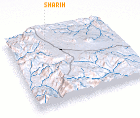 Places with similar names to Shāriḩ, Yemen ::
Disclaimer :: Information on this page comes without warranty of any kind |
||
|
Where is Shāriḩ? Elevation and coordinates ::
Latitude (lat): 14°40'55"N Longitude (lon): 44°16'48"E
Elevation (approx.): 2463m (map arrows pan, magnifying glasses zoom) |
||
|
Visiting Shāriḩ? Hotel/Accommodation ::
Book a hotel in Shāriḩ Travel Guide ::
Buy a travel guide for Yemen rental cars ::
car rental offers GPS waypoint ::
download a GPX waypoint (PoI) of Shāriḩ for your GPS receiver
|
||