|
search place name
|
||
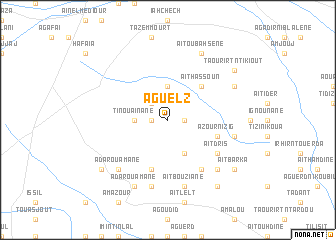
Aguelz (Taroudannt, Morocco)Aguelz is a town in the Taroudannt region of Morocco. An overview map of the region around Aguelz is displayed below.
regional and 3d topo map of Aguelz, Morocco ::
Aguelz airports ::
The nearest airport is AGA - Agadir Inezgane, located 70.5 km west of Aguelz.
Other airports nearby include RAK - Marrakech Menara (161.3 km north east), OZZ - Ouarzazate (195.4 km east), Nearby towns ::
Sidi Irguist (1.6km west) //
Aguelf (1.6km east) //
Ouinizrane (2.4km north west) //
Tinouaïnane (3.2km west) //
Irhilane (3.7km north) //
Tinlasker (4.0km south east) //
Aït Hassoun (4.9km north east) //
Aït Baha (5.8km south) //
Azour nʼIzig (5.1km east) //
Aït Bou nʼ Rhart (6.4km south east) //
Aït Dris (6.1km south east) //
Tilioua (7.6km south) //
Aït Alla (7.6km south) //
Tadiza (7.6km south) //
Aït Bouziane (7.6km south) //
Tarhzout (6.7km east) //
Adar Ou Amane (7.3km south west) //
Et Tnine (7.3km south east) //
Aït Oubahsene (8.1km north east) //
Adar ou-Amane (8.1km south west) //
Aglagal (7.4km north east) //
Tourhert (8.5km south west) //
Aït Bakka (8.8km south east) //
Aït Barka (8.5km south east) //
Taourirt nʼ Tikiout (8.5km north east) //
[all distances 'as the bird flies' and approximate]  Places with similar names to Aguelz, Morocco ::
// Akkilise (TR)
// Agallas (ES)
// Águilas (ES)
// Agouliza (NE)
// Aiguilles (FR)
// Aguelz (MA)
// Aglos (RU)
// Āy Qal‘ehsī (IR)
// Āyqal‘ehsī (IR)
// Agoulzi (MA)
Disclaimer :: Information on this page comes without warranty of any kind |
||
|
Where is Aguelz? Elevation and coordinates ::
Latitude (lat): 30°19'0"N Longitude (lon): 8°49'0"W
Elevation (approx.): 681m (map arrows pan, magnifying glasses zoom) |
||
|
Visiting Aguelz? Hotel/Accommodation ::
Book a hotel in Aguelz Travel Guide ::
Buy a travel guide for Morocco rental cars ::
car rental offers GPS waypoint ::
download a GPX waypoint (PoI) of Aguelz for your GPS receiver
|
||