|
search place name
|
||
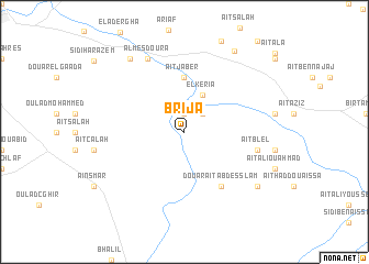
Brija (Fès, Morocco)Brija is a town in the Fès region of Morocco. An overview map of the region around Brija is displayed below.
regional and 3d topo map of Brija, Morocco ::
Brija airports ::
The nearest airport is FEZ - Fez Saiss, located 17.0 km west of Brija.
Other airports nearby include MEK - Meknes Bassatine (66.8 km west), AHU - Al Hociema Cherif El Idrissi (160.6 km north east), NNA - Kentira Kenitra (169.7 km west), RBA - Rabat Sale (180.5 km west), Nearby towns ::
Oulad Jeghigh (1.9km north) //
Zawyat Sidi Salem (2.4km north east) //
El Keria (4.0km north east) //
Aït Jaber (5.6km north) //
Douar Aït Abd es Slam (6.4km south east) //
Aït Blel (6.4km east) //
Isbahine (6.4km east) //
Al Mesdoura (8.0km north west) //
Es Skhinat (8.7km north west) //
Zitouna Aït Khalifa (8.3km south east) //
El Bratel (9.2km north east) //
[all distances 'as the bird flies' and approximate] 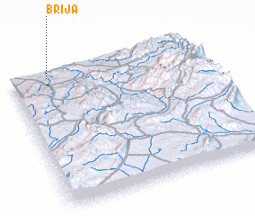 Places with similar names to Brija, Morocco ::
Disclaimer :: Information on this page comes without warranty of any kind |
||
|
Where is Brija? Elevation and coordinates ::
Latitude (lat): 33°58'0"N Longitude (lon): 4°48'0"W
Elevation (approx.): 382m (map arrows pan, magnifying glasses zoom) |
||
|
Visiting Brija? Hotel/Accommodation ::
Book a hotel in Brija Travel Guide ::
Buy a travel guide for Morocco rental cars ::
car rental offers GPS waypoint ::
download a GPX waypoint (PoI) of Brija for your GPS receiver
|
||