|
search place name
|
||
Imdras (Ouarzazate, Morocco)Imdras is a town in the Ouarzazate region of Morocco. An overview map of the region around Imdras is displayed below.
regional and 3d topo map of Imdras, Morocco ::

Imdras airports ::
The nearest airport is OZZ - Ouarzazate, located 66.0 km south west of Imdras.
Other airports nearby include RAK - Marrakech Menara (147.9 km west), CMN - Casablanca Mohammed V Intl (239.7 km north west), Nearby towns ::
Tizguine (0.6km south) //
Assaka (1.2km north east) //
Amassine (1.5km west) //
Tidzguine (2.1km west) //
Assemdou (3.5km south west) //
AïtAlla (3.9km south west) //
Aït Ichou Ou Ali (4.2km south) //
Imi nʼOulaoun (4.3km south) //
Taghra (3.9km west) //
Aït Hammou (4.5km south) //
Azib nʼOuaqqa Amassine (4.3km north west) //
Tirhli (4.7km north east) //
Tessaout nʼAtena (4.7km north east) //
Aït Lahsene (4.3km west) //
Imezil (5.5km south) //
Azib Tagoulzit (5.5km north) //
Tamzzrit (5.2km west) //
Bourmmane (6.1km south) //
Tatrarat (6.1km south east) //
Tighli (6.2km north east) //
Tarbat (6.4km south east) //
Aït Soual (6.3km south east) //
Ighir (6.3km south east) //
Tighouzzirine (6.2km south east) //
Aguerd nʼIgherm (7.3km south) //
Lamtik (6.7km south east) //
Ouaoumeloud (7.3km south) //
Ighil (6.5km east) //
Aït Zouli (6.8km south east) //
[all distances 'as the bird flies' and approximate] 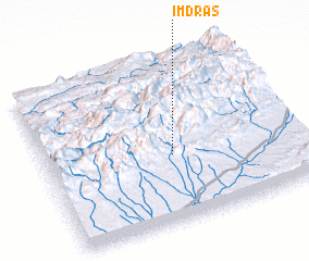 Places with similar names to Imdras, Morocco ::
// Imdras (MA)
Disclaimer :: Information on this page comes without warranty of any kind |
||
|
Where is Imdras? Elevation and coordinates ::
Latitude (lat): 31°24'56"N Longitude (lon): 6°29'42"W
Elevation (approx.): 2070m (map arrows pan, magnifying glasses zoom) |
||
|
Visiting Imdras? Hotel/Accommodation ::
Book a hotel in Imdras Travel Guide ::
Buy a travel guide for Morocco rental cars ::
car rental offers GPS waypoint ::
download a GPX waypoint (PoI) of Imdras for your GPS receiver
|
||