|
search place name
|
||
Tifrhelt (Agadir, Morocco)Tifrhelt is a town in the Agadir region of Morocco. An overview map of the region around Tifrhelt is displayed below.
regional and 3d topo map of Tifrhelt, Morocco ::

Tifrhelt airports ::
The nearest airport is AGA - Agadir Inezgane, located 71.1 km north west of Tifrhelt.
Other airports nearby include RAK - Marrakech Menara (205.6 km north east), Nearby towns ::
Agouremt (1.9km north) //
Imouchyoun (2.5km north east) //
Tirhza (2.5km north east) //
Ifrhel (3.7km south west) //
Ouirane (4.0km north west) //
Tizourgane (5.6km south) //
Aït Ouikhter (4.8km east) //
Taferbiount (5.6km north) //
Talat Mousse (4.8km east) //
Tifrhelt nʼAït Bou Lhaj (4.8km west) //
Tioulit (5.8km south) //
Aïoufis (6.1km south west) //
Tine Zelouadou (6.4km north west) //
Agadir Sidi Yakoub (6.4km north east) //
Tinzad (6.1km north west) //
Tamguert (7.4km north) //
Tiguemmi Ouafa (7.4km south) //
Anguim (7.4km north west) //
Agouni (7.4km north east) //
Ifoullousene (8.1km south west) //
Doudad (7.4km south west) //
Alma (8.8km south west) //
Madao (9.8km south east) //
Taourirt Izogaïne (10.4km north west) //
[all distances 'as the bird flies' and approximate] 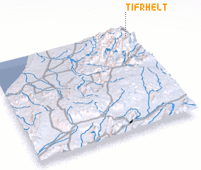 Places with similar names to Tifrhelt, Morocco ::
Disclaimer :: Information on this page comes without warranty of any kind |
||
|
Where is Tifrhelt? Elevation and coordinates ::
Latitude (lat): 29°57'0"N Longitude (lon): 9°0'0"W
Elevation (approx.): 1301m (map arrows pan, magnifying glasses zoom) |
||
|
Visiting Tifrhelt? Hotel/Accommodation ::
Book a hotel in Tifrhelt Travel Guide ::
Buy a travel guide for Morocco rental cars ::
car rental offers GPS waypoint ::
download a GPX waypoint (PoI) of Tifrhelt for your GPS receiver
|
||