|
search place name
|
||
Bacangan (Ilocos Sur, Philippines)Bacangan is a town in the Ilocos Sur region of Philippines. An overview map of the region around Bacangan is displayed below.
regional and 3d topo map of Bacangan, Philippines ::

Bacangan airports ::
The nearest airport is BAG - Baguio, located 76.9 km south of Bacangan.
Nearby towns ::
Capinitan (1.8km east) //
Padaoil (2.0km north west) //
San Elias (2.6km south east) //
Kenmarin (3.7km north) //
Quinvuctut (4.0km south) //
Sigay (3.9km south east) //
Santo Rosario (4.1km north east) //
Batangen (4.0km south east) //
Abaccan (4.1km south east) //
Singlan (4.1km south east) //
Bugbuga (4.4km north west) //
Pa-oc (5.1km north west) //
Duquis (5.1km south east) //
San Ramon (5.1km south east) //
Guinosod (5.1km south east) //
Daligan (5.3km west) //
Mapalina (5.6km south) //
Dinaraton (5.6km north west) //
Sigay (5.6km east) //
San Jose (5.6km west) //
Lungon (5.6km east) //
Lubnac (5.8km south) //
Sorioan (6.4km north) //
San Jose (6.4km north west) //
Arangin-Dinaratan (6.6km north west) //
Tangadan (6.4km east) //
Amarao (6.9km west) //
Paaraban (7.2km south east) //
San Pedro (7.1km west) //
[all distances 'as the bird flies' and approximate] 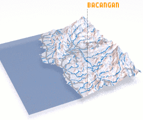 Places with similar names to Bacangan, Philippines ::
// Bacuñgan (PH)
// Bacungan (PH)
// Boca Engaño (PH)
// Bākān-e Kahn (IR)
// Begungaon (BD)
// Bégangon (BJ)
// Bakongan (ID)
// Bekancan (ID)
// Baguiangan (PH)
Disclaimer :: Information on this page comes without warranty of any kind |
||
|
Where is Bacangan? Elevation and coordinates ::
Latitude (lat): 17°4'0"N Longitude (lon): 120°33'0"E
Elevation (approx.): 171m (map arrows pan, magnifying glasses zoom) |
||
|
Visiting Bacangan? Hotel/Accommodation ::
Book a hotel in Bacangan Travel Guide ::
Buy a travel guide for Philippines rental cars ::
car rental offers GPS waypoint ::
download a GPX waypoint (PoI) of Bacangan for your GPS receiver
|
||