|
search place name
|
||
Balagtas (Quezon, Philippines)Balagtas is a town in the Quezon region of Philippines. An overview map of the region around Balagtas is displayed below.
regional and 3d topo map of Balagtas, Philippines ::

Balagtas airports ::
The nearest airport is MNL - Manila Ninoy Aquino Intl, located 132.5 km north west of Balagtas.
Nearby towns ::
Mabini (1.9km north) //
Tagumpay (2.5km south) //
General Luna (2.6km north west) //
Caigdal (2.6km north west) //
Piña (2.6km south east) //
Tubas (2.6km north east) //
Ilayang Casasahan (3.0km east) //
Maputat (3.2km south west) //
Padre Burgos (3.3km east) //
Cabulihan (3.7km south) //
San Isidro (3.7km north) //
Ibabang Casasahan (3.6km east) //
Bitaog (3.6km east) //
Loctob (4.0km south) //
Plaridel (4.1km north west) //
Cawayanin (4.0km north east) //
San Roque (4.3km south) //
Muliguin (4.2km west) //
Bungahan (4.5km north east) //
Malvar (4.8km west) //
Saguinsinan (4.9km east) //
Mabunga (5.0km north east) //
Balanacan (5.0km west) //
Canluran (5.2km north east) //
Sampaloc (5.2km east) //
Sumag (5.3km south east) //
Bonifacio (5.5km north) //
San Roque (5.4km west) //
Almacen (5.5km north west) //
[all distances 'as the bird flies' and approximate] 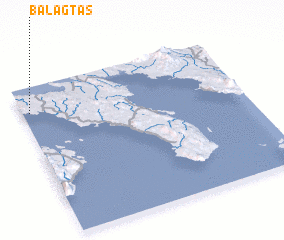 Places with similar names to Balagtas, Philippines ::
// Balacdas (PH)
// Balagatasa (PH)
// Balagtas (PH)
// Balagtas (PH)
// Bū ol Qeyţās (IR)
// Bolektas (KZ)
// Balkautsʼ (UA)
// Balagtas (PH)
Disclaimer :: Information on this page comes without warranty of any kind |
||
|
Where is Balagtas? Elevation and coordinates ::
Latitude (lat): 13°50'0"N Longitude (lon): 122°2'0"E
Elevation (approx.): 84m (map arrows pan, magnifying glasses zoom) |
||
|
Visiting Balagtas? Hotel/Accommodation ::
Book a hotel in Balagtas Travel Guide ::
Buy a travel guide for Philippines rental cars ::
car rental offers GPS waypoint ::
download a GPX waypoint (PoI) of Balagtas for your GPS receiver
|
||