|
search place name
|
||
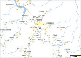
Bangag (Isabela, Philippines)Bangag is a town in the Isabela region of Philippines. An overview map of the region around Bangag is displayed below.
regional and 3d topo map of Bangag, Philippines ::
Bangag airports ::
The nearest airport is BAG - Baguio, located 162.2 km south west of Bangag.
Nearby towns ::
Capo (1.1km south) //
Bangac (1.6km west) //
Marado (2.0km east) //
Tangcul (2.2km east) //
Ilagan (2.5km south) //
Aggassian (2.7km south west) //
Tubo (2.7km south west) //
Salindingan (2.7km south west) //
Vintar (2.7km south west) //
Marana (2.8km south east) //
Angarilla (2.9km south east) //
Manaring (2.9km east) //
Baculod (3.1km west) //
Rugao (3.3km north) //
Naguilian (3.2km west) //
San Pedro (3.7km north west) //
Cammunatan (3.9km south) //
Guinatang (4.2km south west) //
Sipay (4.3km south) //
Andayan (4.2km east) //
Lullutan (4.6km south west) //
Calamagui-Primero (4.7km south west) //
Minabang (4.6km north east) //
San Juan (4.9km north) //
Palutan (5.3km north) //
Calamagui-Segundo (5.2km south west) //
Canapi (5.3km north west) //
Tuyo (5.5km south east) //
Malalam (5.9km south) //
[all distances 'as the bird flies' and approximate] 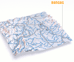 Places with similar names to Bangag, Philippines ::
Disclaimer :: Information on this page comes without warranty of any kind |
||
|
Where is Bangag? Elevation and coordinates ::
Latitude (lat): 17°10'10"N Longitude (lon): 121°53'53"E
Elevation (approx.): 42m (map arrows pan, magnifying glasses zoom) |
||
|
Visiting Bangag? Hotel/Accommodation ::
Book a hotel in Bangag Travel Guide ::
Buy a travel guide for Philippines rental cars ::
car rental offers GPS waypoint ::
download a GPX waypoint (PoI) of Bangag for your GPS receiver
|
||