|
search place name
|
||
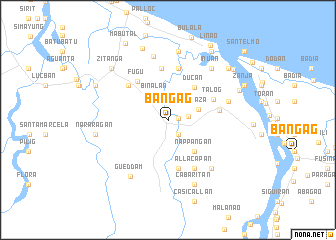
Bangag (Cagayan, Philippines)Bangag is a town in the Cagayan region of Philippines. An overview map of the region around Bangag is displayed below.
regional and 3d topo map of Bangag, Philippines ::
Bangag airports ::
The nearest airport is BAG - Baguio, located 235.0 km south west of Bangag.
Nearby towns ::
Nassirucan (1.1km east) //
Tamboli (2.0km south east) //
Zinarag (2.2km east) //
Binalan (3.0km north west) //
Plaza (3.5km east) //
Nappangan (4.5km south east) //
Ducan (4.6km north east) //
Fugu (5.4km north west) //
Matucay (5.5km south) //
Binubungan (5.5km south) //
Backiling (5.5km south) //
Bulo (5.5km south) //
Cabaggaoan (5.5km south) //
Centromargo (5.5km south) //
Gaddangan (5.5km south) //
Kapanikian (5.5km south) //
Pacac (5.5km south) //
Talog (5.4km north east) //
Catuguran (5.8km north) //
Selong (5.5km east) //
Nabbauangan (5.8km north) //
Uauang (5.7km north west) //
Allacapan (6.1km south east) //
Bukig (6.7km east) //
Maguininango (7.1km south east) //
Maguig (7.1km south east) //
Payagan East (7.3km north) //
Inuan (7.4km north east) //
Gueddam (7.5km south west) //
[all distances 'as the bird flies' and approximate] 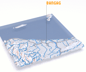 Places with similar names to Bangag, Philippines ::
Disclaimer :: Information on this page comes without warranty of any kind |
||
|
Where is Bangag? Elevation and coordinates ::
Latitude (lat): 18°17'54"N Longitude (lon): 121°33'23"E
Elevation (approx.): 8m (map arrows pan, magnifying glasses zoom) |
||
|
Visiting Bangag? Hotel/Accommodation ::
Book a hotel in Bangag Travel Guide ::
Buy a travel guide for Philippines rental cars ::
car rental offers GPS waypoint ::
download a GPX waypoint (PoI) of Bangag for your GPS receiver
|
||