|
search place name
|
||
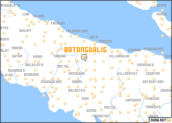
Batong Dalig (Quezon, Philippines)Batong Dalig is a town in the Quezon region of Philippines. An overview map of the region around Batong Dalig is displayed below.
regional and 3d topo map of Batong Dalig, Philippines ::
Batong Dalig airports ::
The nearest airport is MNL - Manila Ninoy Aquino Intl, located 130.0 km north west of Batong Dalig.
Nearby towns ::
Casasahan (1.9km south) //
Ilayang Inagbuhan (1.9km north) //
Villa Victoria (1.9km south) //
Banot (1.9km south) //
Matanag (1.8km west) //
Hardinan (1.8km east) //
Inaclagan (2.0km west) //
San Isidro (2.6km south east) //
Butaguin (2.6km north east) //
Mahabang Bundoc (2.6km south east) //
Bonifacio (2.6km south west) //
Rizal (3.6km west) //
Manlayaan (3.6km east) //
Bungahan (3.9km south) //
Poctol (4.0km south west) //
Villa Arcaya (4.1km north east) //
San Isidro (4.1km south west) //
Canluran (4.1km south east) //
Inagbuhan (4.6km north) //
Bota (4.6km north east) //
Mabunga (4.6km south east) //
Plaridel (5.2km south west) //
San Isidro Silangan (5.2km south east) //
Poctol (5.1km south west) //
Rosario (5.3km north east) //
Tubigan (5.4km west) //
Lanao (5.4km west) //
Tubas (5.6km south) //
Sastre (5.6km east) //
[all distances 'as the bird flies' and approximate] 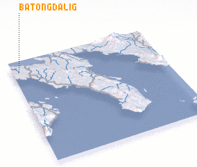 Places with similar names to Batong Dalig, Philippines :: Disclaimer :: Information on this page comes without warranty of any kind |
||
|
Where is Batong Dalig? Elevation and coordinates ::
Latitude (lat): 13°54'0"N Longitude (lon): 122°3'0"E
Elevation (approx.): 97m (map arrows pan, magnifying glasses zoom) |
||
|
Visiting Batong Dalig? Hotel/Accommodation ::
Book a hotel in Batong Dalig Travel Guide ::
Buy a travel guide for Philippines rental cars ::
car rental offers GPS waypoint ::
download a GPX waypoint (PoI) of Batong Dalig for your GPS receiver
|
||