|
search place name
|
||
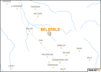
Belomala (South Cotabato, Philippines)Belomala is a town in the South Cotabato region of Philippines. An overview map of the region around Belomala is displayed below.
regional and 3d topo map of Belomala, Philippines ::
Belomala airports ::
The nearest airport is CEB - Cebu Cotabato, located 123.3 km north west of Belomala.
Other airports nearby include LGP - Legazpi Pagadian (233.7 km north west), Nearby towns ::
 Places with similar names to Belomala, Philippines ::
// Balemballeh (ET)
// Ballew Mill (US)
// Blomli (NO)
// Bölümlü (TR)
// Belmil (ES)
// Blue Mill (US)
// Bilāmālia (BD)
// Balambalo (BF)
// Bouloumboulou (CF)
// Boulembali (TD)
Disclaimer :: Information on this page comes without warranty of any kind |
||
|
Where is Belomala? Elevation and coordinates ::
Latitude (lat): 6°21'30"N Longitude (lon): 124°58'47"E
Elevation (approx.): 390m (map arrows pan, magnifying glasses zoom) |
||
|
Visiting Belomala? Hotel/Accommodation ::
Book a hotel in Belomala Travel Guide ::
Buy a travel guide for Philippines rental cars ::
car rental offers GPS waypoint ::
download a GPX waypoint (PoI) of Belomala for your GPS receiver
|
||