|
search place name
|
||
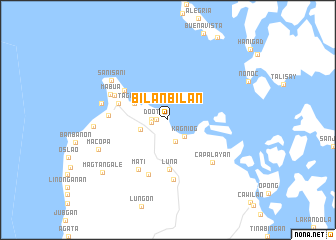
Bilanbilan (Surigao del Norte, Philippines)Bilanbilan is a town in the Surigao del Norte region of Philippines. An overview map of the region around Bilanbilan is displayed below.
regional and 3d topo map of Bilanbilan, Philippines ::
Bilanbilan airports ::
The nearest airport is TAC - Tacloban Daniel Z Romualdez, located 167.9 km north of Bilanbilan.
Other airports nearby include NOP - Masbate Mactan Cebu Intl (176.5 km west), CGY - Ladag Cagayan De Oro (180.1 km south west), Nearby towns ::
Surigao (1.2km west) //
Rizal (1.8km west) //
Doot (1.8km west) //
Arellano (2.5km south) //
Kagniog (2.6km south east) //
Cagmug (2.6km south east) //
Bakud (3.2km west) //
Tagbayani (4.1km north west) //
Luna (5.5km south) //
Araya (5.8km west) //
Lipata (5.8km north west) //
Mat-i (6.4km south west) //
Pactoy (6.4km south) //
Dacuman (6.5km north west) //
Ipil (6.6km west) //
Mabini (6.7km south) //
Capalayan (6.8km south east) //
Mabua (6.9km north west) //
Pamibihan (7.5km west) //
Sani-Sani (7.6km north west) //
San Francisco (8.3km west) //
Macopa (8.4km south west) //
Magtangale (9.3km south west) //
[all distances 'as the bird flies' and approximate]  Places with similar names to Bilanbilan, Philippines ::
// Bulanbulan (PH)
// Buln Buln (AU)
Disclaimer :: Information on this page comes without warranty of any kind |
||
|
Where is Bilanbilan? Elevation and coordinates ::
Latitude (lat): 9°47'0"N Longitude (lon): 125°30'0"E
Elevation (approx.): 7m (map arrows pan, magnifying glasses zoom) |
||
|
Visiting Bilanbilan? Hotel/Accommodation ::
Book a hotel in Bilanbilan Travel Guide ::
Buy a travel guide for Philippines rental cars ::
car rental offers GPS waypoint ::
download a GPX waypoint (PoI) of Bilanbilan for your GPS receiver
|
||