|
search place name
|
||
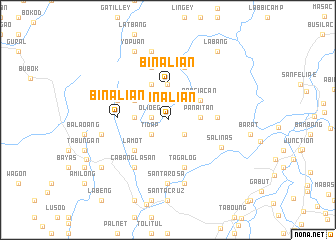
Binalian (Nueva Vizcaya, Philippines)Binalian is a town in the Nueva Vizcaya region of Philippines. An overview map of the region around Binalian is displayed below.
regional and 3d topo map of Binalian, Philippines ::
Binalian airports ::
The nearest airport is BAG - Baguio, located 37.2 km west of Binalian.
Other airports nearby include MNL - Manila Ninoy Aquino Intl (209.1 km south), Nearby towns ::
Nabuag (1.8km west) //
Olioeg (1.8km west) //
Macdu (2.1km north) //
Mapayao (2.4km south east) //
Panaitan (2.4km south west) //
Tidap (2.4km south west) //
San Felipe (2.8km north west) //
Panaitan (3.5km east) //
Inuman (3.5km east) //
Nambodosan (3.6km west) //
Pinayag (4.0km north) //
Binalian (4.0km north) //
Nanciacan (4.1km north east) //
Babaddi (4.2km north west) //
Bibila (4.4km north west) //
Ayom (5.0km south west) //
Lamot (5.0km south west) //
Oplas (5.3km east) //
Tagalog (5.6km south) //
Binalian (5.4km west) //
Banangbang (5.8km west) //
Natbang (6.1km north) //
Bilongat (6.1km north) //
Cabanglasan (6.4km south west) //
Salinas (6.5km south east) //
Santa Rosa (7.1km south) //
Ba-an (7.3km south) //
Banao (7.3km west) //
Hacdal (7.9km north) //
[all distances 'as the bird flies' and approximate]  Places with similar names to Binalian, Philippines ::
Disclaimer :: Information on this page comes without warranty of any kind |
||
|
Where is Binalian? Elevation and coordinates ::
Latitude (lat): 16°23'51"N Longitude (lon): 120°58'1"E
Elevation (approx.): 1357m (map arrows pan, magnifying glasses zoom) |
||
|
Visiting Binalian? Hotel/Accommodation ::
Book a hotel in Binalian Travel Guide ::
Buy a travel guide for Philippines rental cars ::
car rental offers GPS waypoint ::
download a GPX waypoint (PoI) of Binalian for your GPS receiver
|
||