|
search place name
|
||
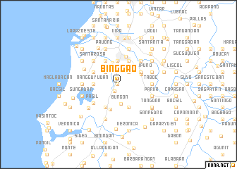
Bing-gao (Ilocos Norte, Philippines)Bing-gao is a town in the Ilocos Norte region of Philippines. An overview map of the region around Bing-gao is displayed below.
regional and 3d topo map of Bing-gao, Philippines ::
Bing-gao airports ::
The nearest airport is BAG - Baguio, located 194.6 km south of Bing-gao.
Nearby towns ::
San Pablo (0.2km west) //
Baay (1.2km south west) //
Catuguing (2.5km north east) //
Samac (2.7km north west) //
Bungon (3.0km south) //
Payes (3.5km north) //
Bugnay (3.8km north) //
Bengcag (3.8km north) //
Nang-guyudan (3.7km west) //
Taguipuro (3.8km north east) //
Barabay (3.8km north east) //
Nagbacalan (4.0km south east) //
Dariwdiw (4.0km south east) //
Barabar (3.8km north east) //
Malingeb (4.1km north) //
Bil-loca (4.1km south) //
Anangui (4.1km south west) //
Raraburan (4.3km north west) //
Caataban (4.2km north west) //
Balacad (4.2km north west) //
San Nicolas (4.6km north) //
Pasil (4.7km south west) //
San Antonio (5.0km north east) //
Taboc (5.1km east) //
San Antonio (5.1km east) //
San Lorenzo (5.1km east) //
Santa Rosa (5.3km north west) //
Pariir (5.4km east) //
San Felipe (5.4km east) //
[all distances 'as the bird flies' and approximate] 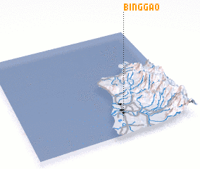 Places with similar names to Bing-gao, Philippines ::
Disclaimer :: Information on this page comes without warranty of any kind |
||
|
Where is Bing-gao? Elevation and coordinates ::
Latitude (lat): 18°7'58"N Longitude (lon): 120°35'7"E
Elevation (approx.): 23m (map arrows pan, magnifying glasses zoom) |
||
|
Visiting Bing-gao? Hotel/Accommodation ::
Book a hotel in Bing-gao Travel Guide ::
Buy a travel guide for Philippines rental cars ::
car rental offers GPS waypoint ::
download a GPX waypoint (PoI) of Bing-gao for your GPS receiver
|
||