|
search place name
|
||
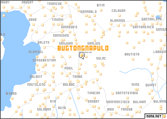
Bugtongnapulo (Lipa, Philippines)Bugtongnapulo is a town in the Lipa region of Philippines. An overview map of the region around Bugtongnapulo is displayed below.
regional and 3d topo map of Bugtongnapulo, Philippines ::
Bugtongnapulo airports ::
The nearest airport is MNL - Manila Ninoy Aquino Intl, located 59.4 km north of Bugtongnapulo.
Nearby towns ::
Bunglio (0.9km north east) //
Plaridel (1.2km south west) //
Inosloban (2.3km south west) //
San Lucas (2.5km north) //
Payapa (2.7km north west) //
Guinting (2.7km south east) //
Dagatan (2.9km south) //
Lumbang (2.9km south east) //
Santiago (3.0km north west) //
San Andres (3.0km west) //
Calicangan (3.0km west) //
Marauoy (3.3km south) //
Balagbag (3.3km south) //
San Luis (3.5km north east) //
San Fernando (4.0km north west) //
Talisay (4.1km south east) //
Bulacanin (4.0km west) //
Sulac (4.1km east) //
Pusil (4.3km south west) //
Balentiouac (4.3km south west) //
San Juan (4.4km north west) //
Santa Cruz (4.4km east) //
Luta (4.7km north) //
Malabanan (4.8km west) //
Bogonong (5.0km south) //
Muntingpulo (5.0km south) //
Santa Clara (5.0km north east) //
San Francisco (5.0km north east) //
Santo Niño (4.9km south east) //
[all distances 'as the bird flies' and approximate]  Places with similar names to Bugtongnapulo, Philippines :: Disclaimer :: Information on this page comes without warranty of any kind |
||
|
Where is Bugtongnapulo? Elevation and coordinates ::
Latitude (lat): 13°59'40"N Longitude (lon): 121°10'39"E
Elevation (approx.): 327m (map arrows pan, magnifying glasses zoom) |
||
|
Visiting Bugtongnapulo? Hotel/Accommodation ::
Book a hotel in Bugtongnapulo Travel Guide ::
Buy a travel guide for Philippines rental cars ::
car rental offers GPS waypoint ::
download a GPX waypoint (PoI) of Bugtongnapulo for your GPS receiver
|
||