|
search place name
|
||
Cambali (La Union, Philippines)Cambali is a town in the La Union region of Philippines. An overview map of the region around Cambali is displayed below.
regional and 3d topo map of Cambali, Philippines ::

Cambali airports ::
The nearest airport is BAG - Baguio, located 32.3 km south east of Cambali.
Nearby towns ::
Baay (0.0km north) //
Garitan (0.0km north) //
Tioañgan (0.0km north) //
Bagulin (1.5km south west) //
Dagup (2.3km north) //
Alibangsay (2.6km south west) //
Suyo (2.6km south east) //
Tagudtud (2.7km south) //
Pacpaco (3.6km west) //
Cardis (4.0km north east) //
Nagyubuyuban (4.0km north west) //
Capran (4.0km north west) //
Bagolig (4.0km north west) //
Tamugdug (4.0km north west) //
Drissoor (4.1km north west) //
Tras (4.1km south east) //
Amontoc (4.8km north) //
Nagyubuyuban (5.1km north west) //
Pongpong (5.1km south east) //
Mamat-ing Norte (5.3km south west) //
Pico (5.3km west) //
Wallayan (5.6km south) //
Pao Norte (5.6km west) //
Baraoas (5.6km west) //
Tunnipe (5.8km south) //
Apayao (5.8km north) //
Dasay (6.2km north west) //
Bimmutubot (6.2km south west) //
Duplas (6.6km north west) //
[all distances 'as the bird flies' and approximate] 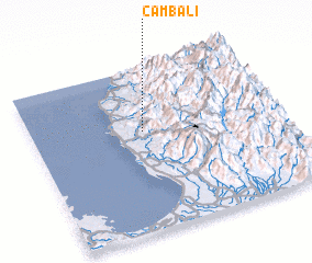 Places with similar names to Cambali, Philippines ::
Disclaimer :: Information on this page comes without warranty of any kind |
||
|
Where is Cambali? Elevation and coordinates ::
Latitude (lat): 16°37'0"N Longitude (lon): 120°27'0"E
Elevation (approx.): 301m (map arrows pan, magnifying glasses zoom) |
||
|
Visiting Cambali? Hotel/Accommodation ::
Book a hotel in Cambali Travel Guide ::
Buy a travel guide for Philippines rental cars ::
car rental offers GPS waypoint ::
download a GPX waypoint (PoI) of Cambali for your GPS receiver
|
||