|
search place name
|
||
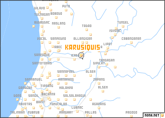
Karusiquis (Ilocos Norte, Philippines)Karusiquis is a town in the Ilocos Norte region of Philippines. An overview map of the region around Karusiquis is displayed below.
regional and 3d topo map of Karusiquis, Philippines ::
Karusiquis airports ::
The nearest airport is BAG - Baguio, located 216.8 km south of Karusiquis.
Nearby towns ::
Bubon ni Posa (1.8km west) //
Icas (1.8km west) //
Allangigan (1.9km north) //
Santa Catalina (2.8km north west) //
Allangigan (3.7km north) //
Pinpinas (3.8km north) //
Balasbas (4.1km south west) //
Alsem (4.1km south east) //
Dipilat (4.0km south east) //
Vira (4.0km north east) //
San Rafael (5.1km south west) //
Puyopoy (5.1km south west) //
Bago (5.1km east) //
Nagparanga (5.3km west) //
Sulbec (5.4km west) //
Tamdagan (5.3km east) //
Danao and Oangagan (5.6km east) //
Cadalman (5.6km west) //
Danao (5.6km east) //
Abec (5.6km west) //
Subic (5.6km west) //
Salad (5.8km north) //
Lipay (6.0km north east) //
Macupit (6.4km south west) //
Manarang (6.6km south west) //
San Pedro (6.4km north west) //
Zapang (6.6km south east) //
Tadao (6.7km north) //
Dilpoc (7.0km north west) //
[all distances 'as the bird flies' and approximate] 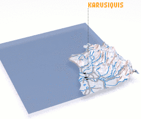 Places with similar names to Karusiquis, Philippines ::
// Carisquis (PH)
// Cross Keys (US)
// Cross Keys (US)
// Groß Quassow (DE)
// Cross Keys (US)
// Carrascais (PT)
// Carrascais (PT)
// Carrascos (PT)
// Carrascos (PT)
// Krzacz (PL)
Disclaimer :: Information on this page comes without warranty of any kind |
||
|
Where is Karusiquis? Elevation and coordinates ::
Latitude (lat): 18°20'0"N Longitude (lon): 120°41'0"E
Elevation (approx.): 241m (map arrows pan, magnifying glasses zoom) |
||
|
Visiting Karusiquis? Hotel/Accommodation ::
Book a hotel in Karusiquis Travel Guide ::
Buy a travel guide for Philippines rental cars ::
car rental offers GPS waypoint ::
download a GPX waypoint (PoI) of Karusiquis for your GPS receiver
|
||