|
search place name
|
||
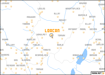
Loacan (Benguet, Philippines)Loacan is a town in the Benguet region of Philippines. An overview map of the region around Loacan is displayed below.
regional and 3d topo map of Loacan, Philippines ::
Loacan airports ::
The nearest airport is BAG - Baguio, located 20.0 km south of Loacan.
Nearby towns ::
Caliking (0.0km north) //
Arubub (2.6km south east) //
Topdak (3.2km east) //
Ba-Ayan (3.6km west) //
Domulpot (3.6km west) //
Tabio (4.1km south east) //
Abiang (4.5km north east) //
Adala (4.7km south east) //
Atok (4.9km north east) //
Chagao (5.1km south west) //
Caponga (5.1km south west) //
Tabuyo (5.8km south) //
Ambongdolan (5.6km west) //
Naguey (6.2km north east) //
Bangko (6.4km south west) //
Damulpot (6.5km south west) //
Bahyan (6.5km south west) //
Tublay (6.5km south west) //
Daklan (6.5km south west) //
Angyapat (6.8km west) //
Datakan (7.1km west) //
Patapat (7.3km east) //
Al-lay (7.6km north) //
Parsoliñgan (7.3km west) //
Bunelon (7.3km west) //
Kapangan (7.9km north west) //
Talaib (8.0km south west) //
Acops Place (8.2km south west) //
Sagubo (8.2km west) //
[all distances 'as the bird flies' and approximate] 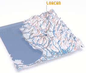 Places with similar names to Loacan, Philippines ::
Disclaimer :: Information on this page comes without warranty of any kind |
||
|
Where is Loacan? Elevation and coordinates ::
Latitude (lat): 16°33'0"N Longitude (lon): 120°40'0"E
Elevation (approx.): 1095m (map arrows pan, magnifying glasses zoom) |
||
|
Visiting Loacan? Hotel/Accommodation ::
Book a hotel in Loacan Travel Guide ::
Buy a travel guide for Philippines rental cars ::
car rental offers GPS waypoint ::
download a GPX waypoint (PoI) of Loacan for your GPS receiver
|
||