|
search place name
|
||
Magdalena (Cagayan, Philippines)Magdalena is a town in the Cagayan region of Philippines. An overview map of the region around Magdalena is displayed below.
regional and 3d topo map of Magdalena, Philippines ::
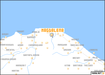
Nearby towns ::
Pata (2.2km north west) //
Namuac (2.4km north east) //
Culao (2.6km north west) //
Buenavista (2.6km south west) //
Mapulapula (2.6km south west) //
Nagrantayan (2.7km east) //
Batitgao (2.9km south west) //
Ammagacan (3.6km east) //
San Roque (4.1km south west) //
Santiago (4.0km south west) //
Panguian (5.1km south east) //
Dibalio (5.5km west) //
Callungan (5.8km east) //
Alimoan (6.0km west) //
Capanniquian (6.8km south west) //
Claveria (6.9km west) //
Surngot (7.0km west) //
Capanniquian (7.7km south east) //
Dagsan (7.7km south east) //
Masisit (8.1km east) //
Nagsaboran (10.1km south west) //
Santa Filomena (10.2km south west) //
Bacsay (11.8km south east) //
[all distances 'as the bird flies' and approximate] 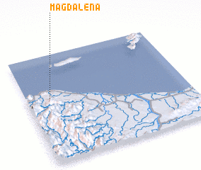 Places with similar names to Magdalena, Philippines ::
// Magdalena (PH)
// Magdalena (PH)
// Magdalena (PH)
// Magdalena (PH)
// Magdalena (PH)
// Magdalenów (PL)
// Magdalenów (PL)
// Magdalena (CU)
// Magdalena (CU)
// Magdalena (CU)
Disclaimer :: Information on this page comes without warranty of any kind |
||
|
Where is Magdalena? Elevation and coordinates ::
Latitude (lat): 18°36'0"N Longitude (lon): 121°9'0"E
Elevation (approx.): 55m (map arrows pan, magnifying glasses zoom) |
||
|
Visiting Magdalena? Hotel/Accommodation ::
Book a hotel in Magdalena Travel Guide ::
Buy a travel guide for Philippines rental cars ::
car rental offers GPS waypoint ::
download a GPX waypoint (PoI) of Magdalena for your GPS receiver
|
||