|
search place name
|
||
Magoon (Agusan del Norte, Philippines)Magoon is a town in the Agusan del Norte region of Philippines. An overview map of the region around Magoon is displayed below.
regional and 3d topo map of Magoon, Philippines ::

Magoon airports ::
The nearest airport is CGY - Ladag Cagayan De Oro, located 100.1 km south west of Magoon.
Other airports nearby include NOP - Masbate Mactan Cebu Intl (214.5 km north west), CEB - Cebu Cotabato (232.8 km south west), LGP - Legazpi Pagadian (242.3 km south west), Nearby towns ::
Culit (1.6km north) //
Agong-ong (2.8km east) //
Macalang (3.6km north east) //
Kinabhangan (4.1km north) //
Rizal (4.5km east) //
Matabao (5.4km north east) //
Ata-atahon (5.7km north) //
Punta (6.6km north) //
Sacol (7.3km north east) //
Buenavista (7.5km north east) //
Guinabsan (7.5km south east) //
Amontay (7.6km north west) //
Talo-ao (7.7km east) //
Nasipit (8.0km north west) //
Malpoc (8.1km east) //
Aclan (8.2km north west) //
Alubijid (8.2km north east) //
Tanula (8.5km south east) //
Talaganao (8.6km east) //
Carmen (9.5km north west) //
[all distances 'as the bird flies' and approximate] 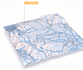 Places with similar names to Magoon, Philippines ::
Disclaimer :: Information on this page comes without warranty of any kind |
||
|
Where is Magoon? Elevation and coordinates ::
Latitude (lat): 8°55'57"N Longitude (lon): 125°21'27"E
Elevation (approx.): 35m (map arrows pan, magnifying glasses zoom) |
||
|
Visiting Magoon? Hotel/Accommodation ::
Book a hotel in Magoon Travel Guide ::
Buy a travel guide for Philippines rental cars ::
car rental offers GPS waypoint ::
download a GPX waypoint (PoI) of Magoon for your GPS receiver
|
||