|
search place name
|
||
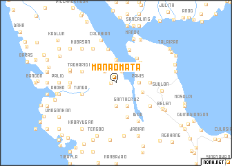
Manaomata (Leyte, Philippines)Manaomata is a town in the Leyte region of Philippines. An overview map of the region around Manaomata is displayed below.
regional and 3d topo map of Manaomata, Philippines ::
Manaomata airports ::
The nearest airport is TAC - Tacloban Daniel Z Romualdez, located 65.4 km east of Manaomata.
Other airports nearby include NOP - Masbate Mactan Cebu Intl (129.6 km south west), BCD - Bacolod (185.3 km south west), ILO - Iloilo (220.9 km west), Nearby towns ::
Kabayugan (0.8km west) //
Tuktuk (2.1km north east) //
Daraon (2.6km north west) //
Parasan (2.6km north west) //
Nipa (3.2km north) //
Rawis (3.6km east) //
Bachao (3.6km east) //
Gimarco (3.7km south) //
Teguit (3.7km north) //
Santa Cruz (4.1km south east) //
Palid (4.1km south east) //
Palarao (4.2km north east) //
Leyte (4.5km east) //
Bako (5.0km north east) //
Santo Niño (5.2km north east) //
Gutusan (5.5km north) //
Burabud (5.5km east) //
Bontogon (5.8km north) //
Tunga (5.8km west) //
Tagharigue (5.8km west) //
Banuyo (5.8km south) //
Sambulawan (6.6km south east) //
Santa Cruz (6.6km north west) //
Igod (7.1km south east) //
Calubian (7.2km north) //
Bonali (7.3km west) //
Maasin (7.4km west) //
Sudlon (7.4km east) //
Manok (7.6km north) //
[all distances 'as the bird flies' and approximate]  Places with similar names to Manaomata, Philippines ::
// Mān Maw-wēt (MM)
// Mān Müt (MM)
// Mān Namhtū (MM)
// Mān Namta (MM)
// Mān Namtai (MM)
// Mān Namtao (MM)
// Mān Namte (MM)
// Manambato (MG)
// Manambato (MG)
// Manambato (MG)
Disclaimer :: Information on this page comes without warranty of any kind |
||
|
Where is Manaomata? Elevation and coordinates ::
Latitude (lat): 11°23'0"N Longitude (lon): 124°27'0"E
Elevation (approx.): 105m (map arrows pan, magnifying glasses zoom) |
||
|
Visiting Manaomata? Hotel/Accommodation ::
Book a hotel in Manaomata Travel Guide ::
Buy a travel guide for Philippines rental cars ::
car rental offers GPS waypoint ::
download a GPX waypoint (PoI) of Manaomata for your GPS receiver
|
||