|
search place name
|
||
Napao (Albay, Philippines)Napao is a town in the Albay region of Philippines. An overview map of the region around Napao is displayed below.
regional and 3d topo map of Napao, Philippines ::

Napao airports ::
The nearest airport is KLO - Kalibo, located 243.0 km south west of Napao.
Nearby towns ::
Tanagan (1.0km south) //
San Antonio (2.3km north west) //
Biña Francia (3.0km north) //
Salvacion (3.9km north) //
Masaguimsim (4.4km south) //
Pongco (4.3km east) //
Manaet (4.8km south) //
Cauayan (4.7km south east) //
Cagraray (4.9km south east) //
Bunga (4.9km east) //
Tambilagao (5.4km east) //
Namantao (5.9km south) //
Agnas (6.2km north west) //
Cajugutan (6.4km south west) //
Mancao (6.6km south east) //
Igang (7.1km south west) //
Cabasan (7.1km west) //
Busdac (7.1km west) //
Binacalan (7.2km south east) //
Nahapunan (7.4km south west) //
San Pedro (7.4km south west) //
Pili (7.6km south west) //
Lipata (7.9km south) //
Domican (7.9km south) //
Tapis (7.7km east) //
Balano (7.9km south west) //
Basud-Vinisitahan (7.9km south west) //
Bacacay (8.0km west) //
San Miguel Estate (8.2km north west) //
[all distances 'as the bird flies' and approximate] 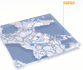 Places with similar names to Napao, Philippines ::
Disclaimer :: Information on this page comes without warranty of any kind |
||
|
Where is Napao? Elevation and coordinates ::
Latitude (lat): 13°19'15"N Longitude (lon): 123°51'43"E
Elevation (approx.): 91m (map arrows pan, magnifying glasses zoom) |
||
|
Visiting Napao? Hotel/Accommodation ::
Book a hotel in Napao Travel Guide ::
Buy a travel guide for Philippines rental cars ::
car rental offers GPS waypoint ::
download a GPX waypoint (PoI) of Napao for your GPS receiver
|
||