|
search place name
|
||
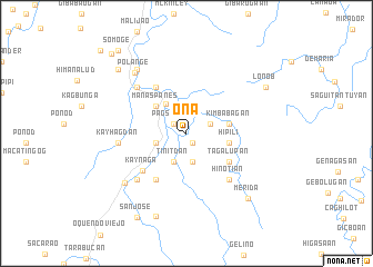
Ona (Northern Samar, Philippines)Ona is a town in the Northern Samar region of Philippines. An overview map of the region around Ona is displayed below.
regional and 3d topo map of Ona, Philippines ::
Ona airports ::
The nearest airport is TAC - Tacloban Daniel Z Romualdez, located 129.0 km south of Ona.
Other airports nearby include BCD - Bacolod (267.8 km south west), Nearby towns ::
Curry (1.1km south east) //
Pagsangan (1.5km north west) //
Coroc (2.5km east) //
Gibunauan (2.5km east) //
Gilino (2.9km south) //
Tinitdan (3.1km south west) //
Buluanga (3.2km west) //
Cervantes (3.6km north west) //
Manaspanes (4.1km north west) //
Kimbabagan (4.3km east) //
Hipili (4.3km east) //
Barini (4.3km east) //
Tagalupan (5.0km south east) //
Gimanalud (5.5km north west) //
Anomon (5.6km south west) //
Kaynaga (5.7km south west) //
Hinotian (6.3km south east) //
Sandinogan (6.7km north west) //
Pagsangan (6.7km north west) //
Ngawo (6.7km south west) //
Kayhagdan (6.7km west) //
Lope de Vega (7.8km south west) //
Polañge (7.9km north west) //
Manalibong (8.1km north west) //
Kapipian (8.9km south) //
Merida (8.9km south east) //
Lon-ob (9.1km north east) //
Paticua (9.3km north west) //
San Jose (9.7km south west) //
[all distances 'as the bird flies' and approximate] 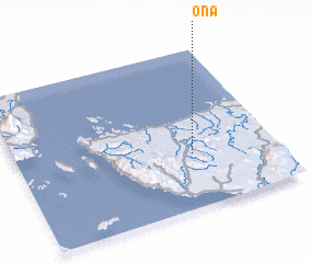 Places with similar names to Ona, Philippines ::
Disclaimer :: Information on this page comes without warranty of any kind |
||
|
Where is Ona? Elevation and coordinates ::
Latitude (lat): 12°20'31"N Longitude (lon): 124°40'41"E
Elevation (approx.): 74m (map arrows pan, magnifying glasses zoom) |
||
|
Visiting Ona? Hotel/Accommodation ::
Book a hotel in Ona Travel Guide ::
Buy a travel guide for Philippines rental cars ::
car rental offers GPS waypoint ::
download a GPX waypoint (PoI) of Ona for your GPS receiver
|
||