|
search place name
|
||
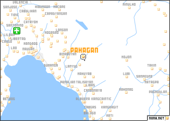
Pahagan (Leyte, Philippines)Pahagan is a town in the Leyte region of Philippines. An overview map of the region around Pahagan is displayed below.
regional and 3d topo map of Pahagan, Philippines ::
Pahagan airports ::
The nearest airport is TAC - Tacloban Daniel Z Romualdez, located 43.8 km north east of Pahagan.
Other airports nearby include NOP - Masbate Mactan Cebu Intl (109.9 km south west), BCD - Bacolod (197.6 km west), DGT - Dumaguete (239.8 km south west), Nearby towns ::
Cantatoc (1.5km south west) //
Lanyug (3.5km south west) //
Bintoan (3.7km south) //
Mahuyab (3.7km south) //
Binabuyan (3.7km west) //
Anas (4.1km south east) //
Capatqan (4.1km south east) //
Mabini (4.1km north west) //
Kancosia (4.8km west) //
Magocdoc (4.9km north west) //
Mahilaom (5.0km north west) //
Donghol (5.5km west) //
Talisayan (5.6km south) //
Balugo (5.6km south) //
Magasue (5.6km west) //
Punta Blanco (5.7km north west) //
Patag (5.8km west) //
Boroc (5.8km west) //
Libas (6.4km south) //
Binoljo (6.4km south west) //
Boroc (6.4km west) //
Patag (6.6km north west) //
Deposito (6.6km south west) //
Florianda (6.6km south west) //
Panalian (6.6km south west) //
Siguinon (6.7km south) //
San Antonio (7.0km south west) //
Patag (7.3km north west) //
Ipil (7.5km west) //
[all distances 'as the bird flies' and approximate] 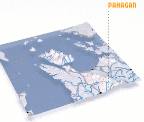 Places with similar names to Pahagan, Philippines ::
// Pahuacan (MX)
Disclaimer :: Information on this page comes without warranty of any kind |
||
|
Where is Pahagan? Elevation and coordinates ::
Latitude (lat): 11°0'0"N Longitude (lon): 124°42'0"E
Elevation (approx.): 417m (map arrows pan, magnifying glasses zoom) |
||
|
Visiting Pahagan? Hotel/Accommodation ::
Book a hotel in Pahagan Travel Guide ::
Buy a travel guide for Philippines rental cars ::
car rental offers GPS waypoint ::
download a GPX waypoint (PoI) of Pahagan for your GPS receiver
|
||