|
search place name
|
||
Panayakan (Aklan, Philippines)Panayakan is a town in the Aklan region of Philippines. An overview map of the region around Panayakan is displayed below.
regional and 3d topo map of Panayakan, Philippines ::

Panayakan airports ::
The nearest airport is KLO - Kalibo, located 19.2 km south east of Panayakan.
Other airports nearby include SJI - San Jose Antique (114.3 km south), ILO - Iloilo (121.1 km south), BCD - Bacolod (145.8 km south east), NOP - Masbate Mactan Cebu Intl (250.5 km south east), Nearby towns ::
Cabugao (2.3km west) //
Arbili (3.0km north east) //
Regador (3.4km north west) //
Tulang (4.0km north) //
Afga (4.2km north east) //
Tamokol (4.2km north east) //
Boctonadoc (4.5km north) //
Naile (4.5km west) //
Tangalan (4.7km north east) //
Rizal (4.8km north west) //
Napatag (5.0km south) //
Malindog (4.9km south west) //
Bugtong Bato (5.2km north) //
Castillo (5.1km south east) //
Dumatad (5.2km north east) //
San Jose (5.2km west) //
Tondog (5.7km north east) //
Dapdap (5.7km north east) //
Calimbajan (5.9km south east) //
Naligusan (5.9km west) //
Naisud (6.0km north west) //
Jawili (6.4km north west) //
Mabusao (6.3km west) //
Dumga (6.7km south east) //
Unat (6.7km west) //
Colongcolong (7.5km north west) //
Alibagon (7.5km south east) //
Yawan (7.5km south west) //
Aparicio (7.7km south west) //
[all distances 'as the bird flies' and approximate] 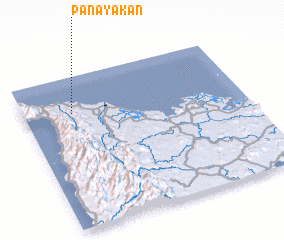
Disclaimer :: Information on this page comes without warranty of any kind |
||
|
Where is Panayakan? Elevation and coordinates ::
Latitude (lat): 11°45'34"N Longitude (lon): 122°13'12"E
Elevation (approx.): 26m (map arrows pan, magnifying glasses zoom) |
||
|
Visiting Panayakan? Hotel/Accommodation ::
Book a hotel in Panayakan Travel Guide ::
Buy a travel guide for Philippines rental cars ::
car rental offers GPS waypoint ::
download a GPX waypoint (PoI) of Panayakan for your GPS receiver
|
||