|
search place name
|
||
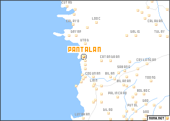
Pantalan (Batangas, Philippines)Pantalan is a town in the Batangas region of Philippines. An overview map of the region around Pantalan is displayed below.
regional and 3d topo map of Pantalan, Philippines ::
Pantalan airports ::
The nearest airport is MNL - Manila Ninoy Aquino Intl, located 62.9 km north east of Pantalan.
Nearby towns ::
Caylaway (0.0km north) //
Putat (0.0km north) //
Reparo (0.0km north) //
Wawa (0.4km north west) //
Nasugbu (1.1km south) //
Maugat (1.9km south) //
Bucana (1.9km south) //
Bunducan (1.9km south) //
Butucan (1.9km south) //
Pataynailog (1.9km south) //
Munting Indang (1.9km south) //
Dagatan (3.2km south) //
Calero (3.7km south) //
Pook (3.6km east) //
Utod (3.7km north) //
Campo (4.0km south) //
Cogunan (4.1km south east) //
Putingkahoy (4.1km south east) //
San Diego (4.9km south) //
Catandaan (5.4km east) //
Lian (5.6km south) //
Kalooñgan (5.8km south) //
Dayap (5.8km north) //
Balanoy (5.8km south) //
Balaytigue (6.6km north west) //
Bilan (6.5km south east) //
Malaruhatan (6.6km south east) //
Bagbag (6.7km south) //
Bulihan (7.3km north) //
[all distances 'as the bird flies' and approximate] 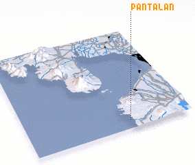 Places with similar names to Pantalan, Philippines ::
// Pentolina (IT)
// Panaitólion (GR)
// Pantaleón (CU)
// Puendeluna (ES)
// Puntallana (ES)
// Puente Llano (CO)
// Punta El Llano (GT)
// Pantoloan (ID)
// Pendalian (ID)
// Pantaleón (MX)
Disclaimer :: Information on this page comes without warranty of any kind |
||
|
Where is Pantalan? Elevation and coordinates ::
Latitude (lat): 14°5'0"N Longitude (lon): 120°38'0"E
Elevation (approx.): 8m (map arrows pan, magnifying glasses zoom) |
||
|
Visiting Pantalan? Hotel/Accommodation ::
Book a hotel in Pantalan Travel Guide ::
Buy a travel guide for Philippines rental cars ::
car rental offers GPS waypoint ::
download a GPX waypoint (PoI) of Pantalan for your GPS receiver
|
||