|
search place name
|
||
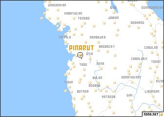
Pinarut (Leyte, Philippines)Pinarut is a town in the Leyte region of Philippines. An overview map of the region around Pinarut is displayed below.
regional and 3d topo map of Pinarut, Philippines ::
Pinarut airports ::
The nearest airport is TAC - Tacloban Daniel Z Romualdez, located 66.7 km east of Pinarut.
Other airports nearby include NOP - Masbate Mactan Cebu Intl (113.0 km south west), BCD - Bacolod (175.2 km west), ILO - Iloilo (212.5 km west), DGT - Dumaguete (243.1 km south west), Nearby towns ::
Ginabuyan (1.4km north west) //
Otin (1.8km east) //
Silad (2.3km south west) //
Taog (2.6km south) //
Cayangian (2.6km south west) //
Tihagong (3.0km north west) //
Villaba (3.5km south west) //
Baranbang (3.8km north) //
Hibuluangan (3.9km south) //
Larey (3.8km north west) //
Calbugos (4.1km north east) //
Balite (4.5km south west) //
Bugabuga (4.8km south) //
Peña (4.8km south east) //
Sangabon (5.2km south west) //
Mambajao (5.2km north east) //
Iligay (5.2km north east) //
Jinagnatan (5.2km north west) //
Tibayla (5.2km north west) //
Sulpa (5.5km south) //
Tipulo (5.6km north) //
Agaoob (5.8km south) //
Sonlagon (5.8km north) //
Bagbacay (5.9km east) //
Burabud (6.6km north west) //
Bulan (6.7km south east) //
Otabon (6.9km north west) //
Kampokpok (6.9km north) //
Tibur (7.2km south west) //
[all distances 'as the bird flies' and approximate]  Places with similar names to Pinarut, Philippines ::
Disclaimer :: Information on this page comes without warranty of any kind |
||
|
Where is Pinarut? Elevation and coordinates ::
Latitude (lat): 11°14'0"N Longitude (lon): 124°25'0"E
Elevation (approx.): 80m (map arrows pan, magnifying glasses zoom) |
||
|
Visiting Pinarut? Hotel/Accommodation ::
Book a hotel in Pinarut Travel Guide ::
Buy a travel guide for Philippines rental cars ::
car rental offers GPS waypoint ::
download a GPX waypoint (PoI) of Pinarut for your GPS receiver
|
||