|
search place name
|
||
San Alfonso (Davao Oriental, Philippines)San Alfonso is a town in the Davao Oriental region of Philippines. An overview map of the region around San Alfonso is displayed below.
regional and 3d topo map of San Alfonso, Philippines ::

San Alfonso airports ::
The nearest airport is CGY - Ladag Cagayan De Oro, located 211.4 km west of San Alfonso.
Nearby towns ::
Aragon (3.3km west) //
Magdalena (3.8km north east) //
Cateel (3.8km east) //
Santa Filomena (3.9km north east) //
San Rafael (4.3km south east) //
Kabasagan (8.8km north west) //
Kamo (9.1km west) //
Mainit (9.2km north west) //
[all distances 'as the bird flies' and approximate] 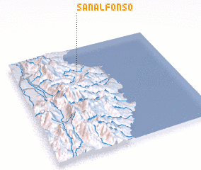 Places with similar names to San Alfonso, Philippines ::
// San Alfonso (CL)
// San Alfonso (CO)
// San Alfonso (CO)
// San Alfonso (CO)
// San Alfonso (CO)
// San Alfonso (EC)
// San Alfonso (EC)
// San Alfonso (SV)
// San Alfonso (MX)
// San Alfonso (MX)
Disclaimer :: Information on this page comes without warranty of any kind |
||
|
Where is San Alfonso? Elevation and coordinates ::
Latitude (lat): 7°46'49"N Longitude (lon): 126°25'13"E
Elevation (approx.): 40m (map arrows pan, magnifying glasses zoom) |
||
|
Visiting San Alfonso? Hotel/Accommodation ::
Book a hotel in San Alfonso Travel Guide ::
Buy a travel guide for Philippines rental cars ::
car rental offers GPS waypoint ::
download a GPX waypoint (PoI) of San Alfonso for your GPS receiver
|
||