|
search place name
|
||
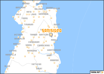
San Isidro (Cebu, Philippines)San Isidro is a town in the Cebu region of Philippines. An overview map of the region around San Isidro is displayed below.
regional and 3d topo map of San Isidro, Philippines ::
San Isidro airports ::
The nearest airport is NOP - Masbate Mactan Cebu Intl, located 73.2 km south of San Isidro.
Other airports nearby include TAC - Tacloban Daniel Z Romualdez (113.2 km east), BCD - Bacolod (125.2 km west), ILO - Iloilo (164.3 km west), KLO - Kalibo (196.6 km north west), Nearby towns ::
Somosa (0.9km north) //
Salag (1.2km east) //
Golon (1.9km north east) //
Mabuang (2.0km north west) //
Mabuli (2.1km south) //
Lib-og (2.4km north east) //
Manlagtang (2.6km south west) //
Santican (2.9km west) //
Tabogon (3.0km south) //
Mabuli (3.4km north west) //
Tangub (3.4km north west) //
Loong (3.5km south west) //
Anonang (3.7km north) //
Cansagoran (3.8km north) //
Odlot (4.0km north east) //
Guadalupe (4.3km north) //
Lusaran (4.7km west) //
Canangay (5.0km west) //
Canaocanao (5.1km south west) //
Daan Tabogon (5.7km south) //
Bantulin (6.0km south) //
Labangon (6.0km south west) //
Tambor (6.5km west) //
Libertad (6.9km north) //
Canagahan (6.9km south west) //
Managase (7.3km south west) //
Tijib (7.3km west) //
Saba (7.6km south) //
San Roque (7.9km north west) //
[all distances 'as the bird flies' and approximate] 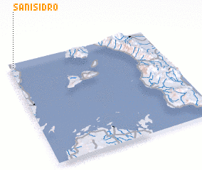 Places with similar names to San Isidro, Philippines ::
// San Ysidro (US)
// San Ysidro (US)
// San Isidro (PA)
// San Isidro (CU)
// San Isidro (CU)
// San Isidro (CU)
// San Isidro (CU)
// San Isidro (CU)
// San Isidro (ES)
// San Isidro (ES)
Disclaimer :: Information on this page comes without warranty of any kind |
||
|
Where is San Isidro? Elevation and coordinates ::
Latitude (lat): 10°58'3"N Longitude (lon): 124°1'34"E
Elevation (approx.): 28m (map arrows pan, magnifying glasses zoom) |
||
|
Visiting San Isidro? Hotel/Accommodation ::
Book a hotel in San Isidro Travel Guide ::
Buy a travel guide for Philippines rental cars ::
car rental offers GPS waypoint ::
download a GPX waypoint (PoI) of San Isidro for your GPS receiver
|
||