|
search place name
|
||
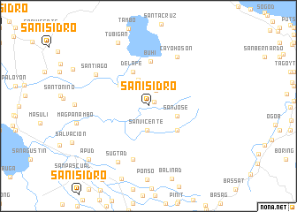
San Isidro (Camarines Sur, Philippines)San Isidro is a town in the Camarines Sur region of Philippines. An overview map of the region around San Isidro is displayed below.
regional and 3d topo map of San Isidro, Philippines ::
San Isidro airports ::
The nearest airport is KLO - Kalibo, located 225.1 km south west of San Isidro.
Nearby towns ::
San Vicente (0.9km north east) //
Antipolo (2.1km north east) //
San Vicente (3.1km south) //
Sagrada Familia (3.6km north) //
San Jose (3.7km east) //
Santa Justina (4.4km north west) //
San Jose (4.7km south east) //
Santa Isabel (4.7km north west) //
Salvacion (4.7km north west) //
Santa Lourdes (4.7km north west) //
De la Fé (4.7km north west) //
De los Angeles (4.7km north west) //
San Rafael (4.7km north west) //
Buhi (5.6km north) //
Lanigay (7.1km south) //
Cayohoson (7.1km north east) //
Santiago (7.5km north west) //
Sugtad (8.1km south west) //
Tubigan (8.9km north west) //
Apud (10.0km south west) //
Libon (12.2km south west) //
[all distances 'as the bird flies' and approximate] 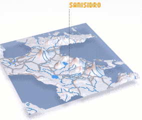 Places with similar names to San Isidro, Philippines ::
// San Ysidro (US)
// San Ysidro (US)
// San Isidro (PA)
// San Isidro (CU)
// San Isidro (CU)
// San Isidro (CU)
// San Isidro (CU)
// San Isidro (CU)
// San Isidro (ES)
// San Isidro (ES)
Disclaimer :: Information on this page comes without warranty of any kind |
||
|
Where is San Isidro? Elevation and coordinates ::
Latitude (lat): 13°22'40"N Longitude (lon): 123°31'4"E
Elevation (approx.): 128m (map arrows pan, magnifying glasses zoom) |
||
|
Visiting San Isidro? Hotel/Accommodation ::
Book a hotel in San Isidro Travel Guide ::
Buy a travel guide for Philippines rental cars ::
car rental offers GPS waypoint ::
download a GPX waypoint (PoI) of San Isidro for your GPS receiver
|
||