|
search place name
|
||
San Rafael (Quezon, Philippines)San Rafael is a town in the Quezon region of Philippines. An overview map of the region around San Rafael is displayed below.
regional and 3d topo map of San Rafael, Philippines ::

San Rafael airports ::
The nearest airport is MNL - Manila Ninoy Aquino Intl, located 81.9 km north west of San Rafael.
Nearby towns ::
San Miguel (1.9km south) //
Baao (1.8km east) //
Banot (3.7km north) //
Luyaluya (3.6km east) //
Tapiyan (3.6km east) //
Owain Ibaba (4.1km north west) //
Owain Ilaya (4.0km south west) //
Saban (4.9km north east) //
Sampaloc (5.0km west) //
San Bueno (5.2km north west) //
Lual (5.2km north east) //
Santol (5.2km north east) //
Bayoñgon (5.7km west) //
Bilucao (5.7km west) //
Alupay (5.7km west) //
Apasan (5.7km west) //
Bataan (5.7km west) //
San Bastian (5.7km east) //
Tapucan (5.7km east) //
San Roque (5.8km north) //
Balaybalay (5.8km south) //
Bato (6.0km north east) //
Taquico (6.5km north west) //
Soledad (6.6km north east) //
Mauban (6.9km north east) //
Abo-abo (7.4km north) //
Mamala (7.4km west) //
Alitock (7.4km east) //
Tubigan (7.7km north east) //
[all distances 'as the bird flies' and approximate] 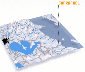 Places with similar names to San Rafael, Philippines ::
// San Rafael (US)
// San Rafael (US)
// Sonoraville (US)
// San Rafael (PA)
// San Rafael (PA)
// San Ruffillo (IT)
// San Rafael (CU)
// San Rafael (CU)
// San Rafael (CU)
// San Rafael (CU)
Disclaimer :: Information on this page comes without warranty of any kind |
||
|
Where is San Rafael? Elevation and coordinates ::
Latitude (lat): 14°9'0"N Longitude (lon): 121°41'0"E
Elevation (approx.): 13m (map arrows pan, magnifying glasses zoom) |
||
|
Visiting San Rafael? Hotel/Accommodation ::
Book a hotel in San Rafael Travel Guide ::
Buy a travel guide for Philippines rental cars ::
car rental offers GPS waypoint ::
download a GPX waypoint (PoI) of San Rafael for your GPS receiver
|
||