|
search place name
|
||
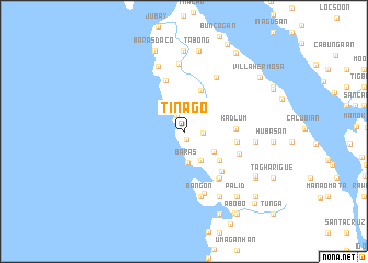
Tinago (Leyte, Philippines)Tinago is a town in the Leyte region of Philippines. An overview map of the region around Tinago is displayed below.
regional and 3d topo map of Tinago, Philippines ::
Tinago airports ::
The nearest airport is TAC - Tacloban Daniel Z Romualdez, located 81.1 km east of Tinago.
Other airports nearby include NOP - Masbate Mactan Cebu Intl (130.9 km south), BCD - Bacolod (175.6 km south west), ILO - Iloilo (209.8 km south west), KLO - Kalibo (213.4 km west), Nearby towns ::
Matungaw (0.8km south) //
Daha (1.8km north west) //
Calunasan (1.9km east) //
Baras (3.2km south) //
Butak (3.4km south east) //
Kabungaan (3.6km south east) //
Bunakan (4.5km north) //
Pananawan (4.6km south east) //
Kadlum (5.2km east) //
Taglawigan (5.5km north) //
Linao (5.4km east) //
Kabinitan (5.4km east) //
Bagakay (5.4km east) //
San Isidro (5.5km south east) //
Tabing (5.9km south east) //
Hubay (6.0km south east) //
Taglawigan (6.0km south east) //
Susimbahan (6.4km north east) //
Aurora (6.6km south) //
Bangon (6.8km south) //
Pananawan (6.9km north) //
Bagulangsang (7.1km north) //
Dulao (7.2km east) //
Bugnay (7.5km south east) //
Anislangan (8.2km north) //
Tabong (8.4km north) //
Bangon (8.5km south east) //
Palid (8.5km south east) //
Hugpa (8.5km south east) //
[all distances 'as the bird flies' and approximate] 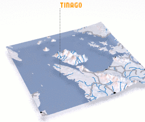 Places with similar names to Tinago, Philippines ::
Disclaimer :: Information on this page comes without warranty of any kind |
||
|
Where is Tinago? Elevation and coordinates ::
Latitude (lat): 11°26'34"N Longitude (lon): 124°19'4"E
Elevation (approx.): 52m (map arrows pan, magnifying glasses zoom) |
||
|
Visiting Tinago? Hotel/Accommodation ::
Book a hotel in Tinago Travel Guide ::
Buy a travel guide for Philippines rental cars ::
car rental offers GPS waypoint ::
download a GPX waypoint (PoI) of Tinago for your GPS receiver
|
||