|
search place name
|
||
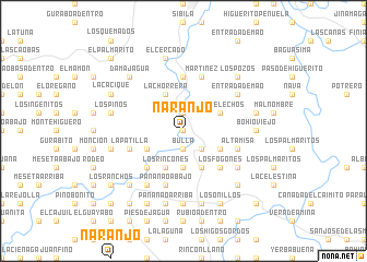
Naranjo (Santiago, Dominican Republic)Naranjo is a town in the Santiago region of Dominican Republic. An overview map of the region around Naranjo is displayed below.
regional and 3d topo map of Naranjo, Dominican Republic ::
Naranjo airports ::
The nearest airport is STI - Santiago Cibao Intl, located 50.4 km east of Naranjo.
Other airports nearby include POP - Puerto Plata Gregorio Luperon Intl (64.7 km north east), CAP - Cap Haitien Intl (121.2 km west), BRX - Barahona Maria Montez Intl (130.9 km south), PAP - Port-au-prince Toussaint Louverture Intl (158.5 km south west), Nearby towns ::
Hato Viejo (0.0km north) //
Bulla (1.9km south) //
Caña (1.9km north) //
Bajón (1.9km north) //
Cañafistol (2.5km south east) //
Barranca del Novillo (3.7km south) //
La Penda (4.1km south east) //
La Palmita (4.1km south east) //
Celestina (4.0km south east) //
Los Rincones (4.1km south west) //
Córbano (4.1km south west) //
Los Helechos (4.0km north east) //
Damajagua (4.0km south west) //
Beladero (4.0km south west) //
La Majagua (4.0km south west) //
La Chorrera (4.1km north west) //
Los Fogones (5.1km south east) //
El Hoyito (5.1km south east) //
Estrechuras de las Negras (5.1km south west) //
El Cercado (5.6km north) //
Jiménez (5.6km north) //
El Mamoncito (5.6km west) //
Botoncillo (5.6km west) //
La Patilla (5.6km west) //
Martínez (5.8km north) //
Altamisa (5.6km east) //
Sabana Abajo (5.6km east) //
Cañada Grande (5.6km east) //
Pananao Abajo (5.8km south) //
[all distances 'as the bird flies' and approximate] 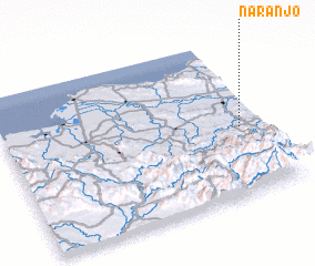 Places with similar names to Naranjo, Dominican Republic ::
Disclaimer :: Information on this page comes without warranty of any kind |
||
|
Where is Naranjo? Elevation and coordinates ::
Latitude (lat): 19°26'0"N Longitude (lon): 71°5'0"W
Elevation (approx.): 154m (map arrows pan, magnifying glasses zoom) |
||
|
Visiting Naranjo? Hotel/Accommodation ::
Book a hotel in Naranjo Travel Guide ::
rental cars ::
car rental offers GPS waypoint ::
download a GPX waypoint (PoI) of Naranjo for your GPS receiver
|
||