|
search place name
|
||
Pokutʼye (Mahilyowskaya Voblastsʼ, Belarus)Pokutʼye is a town in the Mahilyowskaya Voblastsʼ region of Belarus. An overview map of the region around Pokutʼye is displayed below.
regional and 3d topo map of Pokutʼye, Belarus ::

Pokutʼye airports ::
The nearest airport is VTB - Vitebsk, located 125.9 km north west of Pokutʼye.
Other airports nearby include GME - Gomel (175.9 km south), Nearby towns ::
Manʼkovka (2.9km north) //
Ledeshnya (2.1km west) //
Gololobovka (3.2km south east) //
Tëmnyy Les (3.8km east) //
Yesʼkova (5.1km north east) //
Nikolʼskoye (6.3km north) //
Bolʼshoye Zapolʼye (6.4km south) //
Leopolʼye (8.8km north) //
Kartyzhy (6.3km south east) //
Klednevichi (8.6km north west) //
Galënki (9.9km north east) //
[all distances 'as the bird flies' and approximate] 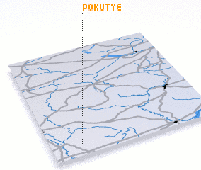
Disclaimer :: Information on this page comes without warranty of any kind |
||
|
Where is Pokutʼye? Elevation and coordinates ::
Latitude (lat): 54°6'15"N Longitude (lon): 31°10'55"E
Elevation (approx.): 204m (map arrows pan, magnifying glasses zoom) |
||
|
Visiting Pokutʼye? Hotel/Accommodation ::
Book a hotel in Pokutʼye Travel Guide ::
Buy a travel guide for Belarus rental cars ::
car rental offers GPS waypoint ::
download a GPX waypoint (PoI) of Pokutʼye for your GPS receiver
|
||