|
search place name
|
||
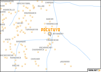
Pocutuyo (Huánuco, Peru)Pocutuyo is a town in the Huánuco region of Peru. An overview map of the region around Pocutuyo is displayed below.
regional and 3d topo map of Pocutuyo, Peru ::
Pocutuyo airports ::
The nearest airport is ATA - Anta Comandante Fap German Arias Graziani, located 200.6 km north west of Pocutuyo.
Other airports nearby include LIM - Lima Jorge Chavez Intl (211.7 km south west), Nearby towns ::
Mesapata (1.2km south west) //
Corral Cancha (2.1km north) //
Quishuarhuasi (2.4km north west) //
Cogancocha (2.5km south) //
Piana (2.8km south) //
Antamaray (2.8km east) //
Pucanito (3.1km north west) //
Ocllac (3.1km south) //
Chaquicocha (3.5km north west) //
Chalhuacocha (3.6km south) //
Yanapaccha (3.7km north) //
San Joaquin (3.7km north west) //
Santa Ana (5.2km north west) //
Gocampampa (5.2km south) //
Huacan (5.4km north) //
Pachamachay (5.5km south) //
Tupinhuayra (7.1km west) //
Chunomarca (7.6km south west) //
Chacos (8.2km north west) //
Matihuaca (9.2km north west) //
Cruzcag (9.2km north west) //
Puquio (9.7km north west) //
Pagrahuaca (10.7km north west) //
Chaprin (12.0km south west) //
[all distances 'as the bird flies' and approximate] 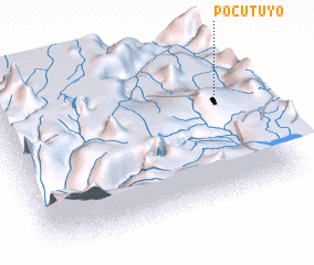
Disclaimer :: Information on this page comes without warranty of any kind |
||
|
Where is Pocutuyo? Elevation and coordinates ::
Latitude (lat): 10°23'24"S Longitude (lon): 76°6'6"W
Elevation (approx.): 4291m (map arrows pan, magnifying glasses zoom) |
||
|
Visiting Pocutuyo? Hotel/Accommodation ::
Book a hotel in Pocutuyo Travel Guide ::
Buy a travel guide for Peru rental cars ::
car rental offers GPS waypoint ::
download a GPX waypoint (PoI) of Pocutuyo for your GPS receiver
|
||