|
search place name
|
||
Darteti (Chin, Myanmar)Darteti is a town in the Chin region of Myanmar. An overview map of the region around Darteti is displayed below.
regional and 3d topo map of Darteti, Myanmar ::

Darteti airports ::
The nearest airport is AJL - Aizwal Aizawl, located 105.6 km north west of Darteti.
Other airports nearby include CGP - Chittagong Shah Amanat Intl (190.0 km south west), IMF - Imphal (198.0 km north), IXH - Kailashahar (206.5 km north west), IXS - Silchar (215.8 km north), Nearby towns ::
Zawlte (3.7km north) //
Dihai (3.7km south) //
Haimual (3.4km west) //
Roshi (3.9km north east) //
Zawngte (3.9km north west) //
Khiangrawn (6.3km north east) //
Tikhaunglum (6.5km south west) //
Thinghual (6.3km south west) //
Vawmhalkhum (7.4km north) //
Hnahthial (6.8km west) //
Khualung (7.4km south) //
Ngailan (7.8km north west) //
Lotharawn (9.0km north east) //
Tlāngkawi (9.0km north west) //
[all distances 'as the bird flies' and approximate] 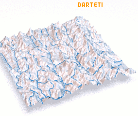 Places with similar names to Darteti, Myanmar ::
// Tuora-Tiit (RU)
// Tourtit (MA)
// Torredeita (PT)
// Trædet (NO)
// Dar Titi (TN)
// Douar Douaïdia (TN)
// Douar Douaouda (TN)
// Tardad (ES)
// Dār-e Tūt (IR)
// Dār Tūt (IR)
Disclaimer :: Information on this page comes without warranty of any kind |
||
|
Where is Darteti? Elevation and coordinates ::
Latitude (lat): 23°1'0"N Longitude (lon): 93°28'0"E
Elevation (approx.): 1289m (map arrows pan, magnifying glasses zoom) |
||
|
Visiting Darteti? Hotel/Accommodation ::
Book a hotel in Darteti Travel Guide ::
Buy a travel guide for Myanmar rental cars ::
car rental offers GPS waypoint ::
download a GPX waypoint (PoI) of Darteti for your GPS receiver
|
||