|
search place name
|
||
Hintha (Kachin State, Myanmar)Hintha is a town in the Kachin State region of Myanmar. An overview map of the region around Hintha is displayed below.
regional and 3d topo map of Hintha, Myanmar ::

Hintha airports ::
The nearest airport is MYT - Myitkyina, located 110.9 km north of Hintha.
Other airports nearby include LSH - Lashio (160.1 km south), Nearby towns ::
Tai-chaung (0.0km north) //
Naungleik (1.7km west) //
Konsin (1.7km west) //
N'hkrut (1.7km east) //
Ugyi (1.7km east) //
Naunghpaung (2.5km south west) //
Sikaw (2.5km north west) //
Myothit (2.5km north east) //
Myohaung (2.5km north east) //
Zaibru (4.1km south east) //
N'hkrut (3.9km south east) //
Tinghkam (3.9km north east) //
Mān Ye (5.0km south west) //
Ma-ubin (5.0km south west) //
Mān Cham (5.0km north east) //
Naungpaw (5.1km west) //
Naungpaung (5.6km north) //
Kabani (5.4km west) //
Si-ngin (5.8km south) //
Mainghka (6.5km north east) //
Sihet (6.5km north east) //
Mān Naung (6.3km north west) //
Chyāhkan (7.4km south) //
Shāre (6.8km east) //
Nawku (7.0km east) //
Panchohaing (7.6km north) //
Hophai (7.5km south west) //
Kalehkyet (7.7km south east) //
Nanhlaing (8.7km south west) //
[all distances 'as the bird flies' and approximate] 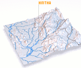 Places with similar names to Hintha, Myanmar ::
Disclaimer :: Information on this page comes without warranty of any kind |
||
|
Where is Hintha? Elevation and coordinates ::
Latitude (lat): 24°23'0"N Longitude (lon): 97°23'0"E
Elevation (approx.): 119m (map arrows pan, magnifying glasses zoom) |
||
|
Visiting Hintha? Hotel/Accommodation ::
Book a hotel in Hintha Travel Guide ::
Buy a travel guide for Myanmar rental cars ::
car rental offers GPS waypoint ::
download a GPX waypoint (PoI) of Hintha for your GPS receiver
|
||