|
search place name
|
||
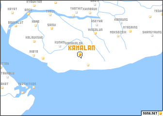
Kamalan (Yangon, Myanmar)Kamalan is a town in the Yangon region of Myanmar. An overview map of the region around Kamalan is displayed below.
regional and 3d topo map of Kamalan, Myanmar ::
Kamalan airports ::
The nearest airport is RGN - Yangon Intl, located 52.7 km north west of Kamalan.
Nearby towns ::
 Places with similar names to Kamalan, Myanmar ::
// Cambalion (PH)
// Guimbalaon (PH)
// Guimbialan (PH)
// Kamalian (PH)
// Gamehlen (DE)
// Gummlin (DE)
// Kamalino (US)
// Kmehlen (DE)
// Ca Molini (IT)
// Gomulin (PL)
Disclaimer :: Information on this page comes without warranty of any kind |
||
|
Where is Kamalan? Elevation and coordinates ::
Latitude (lat): 16°31'41"N Longitude (lon): 96°25'55"E
Elevation (approx.): 6m (map arrows pan, magnifying glasses zoom) |
||
|
Visiting Kamalan? Hotel/Accommodation ::
Book a hotel in Kamalan Travel Guide ::
Buy a travel guide for Myanmar rental cars ::
car rental offers GPS waypoint ::
download a GPX waypoint (PoI) of Kamalan for your GPS receiver
|
||