|
search place name
|
||
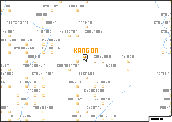
Kangon (Sagaing, Myanmar)Kangon is a town in the Sagaing region of Myanmar. An overview map of the region around Kangon is displayed below.
regional and 3d topo map of Kangon, Myanmar ::
Kangon airports ::
The nearest airport is LSH - Lashio, located 217.4 km south east of Kangon.
Other airports nearby include MYT - Myitkyina (220.2 km north east), IMF - Imphal (222.2 km north west), Nearby towns ::
Zayit-in (1.7km west) //
Pile-ywa (1.7km east) //
Zibyugon (3.4km east) //
Metkalet (3.7km south) //
Kaungba-ywa (3.9km south west) //
Seikpin (5.8km north) //
O-hma (5.8km south) //
In-gyi-let (5.8km south) //
Dobin (5.4km east) //
Dewa (5.8km south) //
Chaunggyi (5.8km north) //
Yun-o (5.8km south) //
Kywegyan (6.5km north west) //
Tatpyin (6.5km north west) //
Kyundaw (6.5km south east) //
Shwege (7.4km north) //
Nankan (7.4km north) //
Gyodaung (7.0km west) //
Taung-in (7.6km south) //
Kyauktaga (7.6km south) //
Myaukywa (7.7km north west) //
Shanagyin (7.7km south west) //
The-gyaung (7.7km south west) //
Mawka (10.0km north west) //
Budagon-ywa (10.0km north west) //
[all distances 'as the bird flies' and approximate] 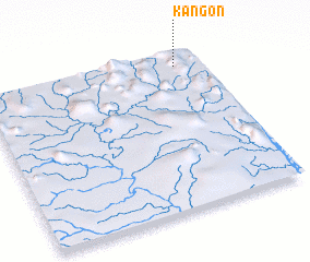 Places with similar names to Kangon, Myanmar ::
Disclaimer :: Information on this page comes without warranty of any kind |
||
|
Where is Kangon? Elevation and coordinates ::
Latitude (lat): 23°55'0"N Longitude (lon): 95°53'0"E
Elevation (approx.): 240m (map arrows pan, magnifying glasses zoom) |
||
|
Visiting Kangon? Hotel/Accommodation ::
Book a hotel in Kangon Travel Guide ::
Buy a travel guide for Myanmar rental cars ::
car rental offers GPS waypoint ::
download a GPX waypoint (PoI) of Kangon for your GPS receiver
|
||