|
search place name
|
||
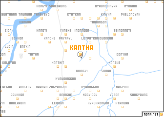
Kantha (Mandalay, Myanmar)Kantha is a town in the Mandalay region of Myanmar. An overview map of the region around Kantha is displayed below.
regional and 3d topo map of Kantha, Myanmar ::
Kantha airports ::
The nearest airport is MDL - Mandalay Intl, located 58.2 km north of Kantha.
Other airports nearby include HEH - Heho (89.6 km south east), LSH - Lashio (264.1 km north east), Nearby towns ::
Thinganzwe (1.7km east) //
Khingyi (3.7km south) //
Payazu (3.9km south west) //
Letpatkon (4.1km north east) //
Ingan (4.1km north east) //
Dainggaungkon (3.9km north west) //
Nyaungbinhla (3.9km north west) //
Payapyu (5.1km north west) //
Ingangon (5.6km north) //
Hteinbin-in (5.5km west) //
Kanthit (5.5km west) //
Suban (6.4km south east) //
Odokkon (6.4km north east) //
Ywashe (6.5km north west) //
Myedaingkan (6.5km south west) //
Kyaunggon (7.6km south) //
Kanzwe (7.2km east) //
Myingyakan (7.2km east) //
Nyaungbintha (7.6km south) //
Nyaungokpi (8.2km south east) //
Konywa (8.2km south east) //
Mingon (8.2km south east) //
Dongon (8.2km south east) //
Tanbingon (8.2km north east) //
Kangwe (7.8km north west) //
Zagyangon (9.0km south west) //
Myogon (8.9km north east) //
Myotha (9.0km north east) //
[all distances 'as the bird flies' and approximate]  Places with similar names to Kantha, Myanmar ::
Disclaimer :: Information on this page comes without warranty of any kind |
||
|
Where is Kantha? Elevation and coordinates ::
Latitude (lat): 21°11'0"N Longitude (lon): 96°4'0"E
Elevation (approx.): 121m (map arrows pan, magnifying glasses zoom) |
||
|
Visiting Kantha? Hotel/Accommodation ::
Book a hotel in Kantha Travel Guide ::
Buy a travel guide for Myanmar rental cars ::
car rental offers GPS waypoint ::
download a GPX waypoint (PoI) of Kantha for your GPS receiver
|
||