|
search place name
|
||
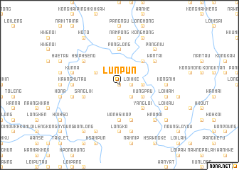
Lun-pun (Shan, Myanmar)Lun-pun is a town in the Shan region of Myanmar. An overview map of the region around Lun-pun is displayed below.
regional and 3d topo map of Lun-pun, Myanmar ::
Lun-pun airports ::
The nearest airport is HEH - Heho, located 138.1 km south west of Lun-pun.
Other airports nearby include LSH - Lashio (141.9 km north), MDL - Mandalay Intl (173.0 km west), KET - Kengtung (210.5 km east), MOG - Mong Hsat (212.2 km south east), Nearby towns ::
Namhu (0.0km north) //
Loi-hke (1.7km east) //
Nwè-hsem (2.5km south east) //
Tonglong (3.4km east) //
Kungpau (3.9km south east) //
Nawnghpa (3.9km north west) //
Yangloi (5.1km south east) //
Pa-pan (5.1km north east) //
Wān Hsi-kap (5.6km south) //
Panglong (5.6km north) //
Panghpit (5.8km south) //
Sanglik (5.5km west) //
Wan Tai (6.4km north east) //
Hsiphseng (6.4km north west) //
Kawngmu-tau (6.9km west) //
Wan Hkai (6.9km west) //
Nampong (7.4km north) //
Kongnim (6.9km east) //
Longka (7.4km south) //
Nam-hku (7.6km south) //
Nawnghkam (7.1km west) //
Loi-ham (7.1km east) //
Mān-sawk (7.1km west) //
Kunna (7.1km west) //
Hpā-mai (7.6km south east) //
Nā-hkan (7.6km south east) //
Pangniu (7.6km north east) //
Kong-mong (8.2km north east) //
Ho-mang (8.2km north east) //
[all distances 'as the bird flies' and approximate] 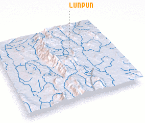 Places with similar names to Lun-pun, Myanmar ::
Disclaimer :: Information on this page comes without warranty of any kind |
||
|
Where is Lun-pun? Elevation and coordinates ::
Latitude (lat): 21°42'0"N Longitude (lon): 97°39'0"E
Elevation (approx.): 1120m (map arrows pan, magnifying glasses zoom) |
||
|
Visiting Lun-pun? Hotel/Accommodation ::
Book a hotel in Lun-pun Travel Guide ::
Buy a travel guide for Myanmar rental cars ::
car rental offers GPS waypoint ::
download a GPX waypoint (PoI) of Lun-pun for your GPS receiver
|
||