|
search place name
|
||
Möng Htam (Shan, Myanmar)Möng Htam is a town in the Shan region of Myanmar. An overview map of the region around Möng Htam is displayed below.
regional and 3d topo map of Möng Htam, Myanmar ::

Möng Htam airports ::
The nearest airport is LSH - Lashio, located 91.9 km south west of Möng Htam.
Other airports nearby include MYT - Myitkyina (224.4 km north west), Nearby towns ::
Mān Ho-na (1.9km south) //
Mān Mau (2.5km north east) //
Mān Kawnghka (3.7km south) //
Mān Panghsak (3.4km east) //
Mān Punghsoi (3.4km west) //
Mān Namhpaklün (4.1km south west) //
Mān Sawnmen (3.9km north east) //
Mān Namhping (3.9km south west) //
Mān Kūmka (5.0km south east) //
Mān Pangkaw (5.0km north west) //
Mān Nawkkiu (5.6km north) //
Mān Ho-hkang (5.8km north) //
Mān Pāngsām (5.4km west) //
Mān Hō-hping (5.8km south) //
Mān Htunleng (6.3km south west) //
Mān Na-hkai (6.5km south west) //
Mān Ho-et (6.3km north east) //
Mān Loi-wēng (7.4km south) //
Mān Kawngwoi (6.8km west) //
Mān Loi-pek (7.6km south) //
Mān Lomhkawng (7.0km east) //
Mān Nawnghsampu (7.0km west) //
Mān Sonmawn (7.6km north) //
Mān Pung (7.6km north) //
Mān Hawnglük (7.5km north west) //
Mān Panghkēn (8.2km south west) //
Mān Loi-hpwi (7.7km south west) //
Mān Hpa-ūm (8.2km north east) //
Mān Pingkūt (9.0km south west) //
[all distances 'as the bird flies' and approximate] 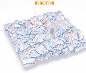 Places with similar names to Möng Htam, Myanmar :: Disclaimer :: Information on this page comes without warranty of any kind |
||
|
Where is Möng Htam? Elevation and coordinates ::
Latitude (lat): 23°35'0"N Longitude (lon): 98°22'0"E
Elevation (approx.): 1109m (map arrows pan, magnifying glasses zoom) |
||
|
Visiting Möng Htam? Hotel/Accommodation ::
Book a hotel in Möng Htam Travel Guide ::
Buy a travel guide for Myanmar rental cars ::
car rental offers GPS waypoint ::
download a GPX waypoint (PoI) of Möng Htam for your GPS receiver
|
||