|
search place name
|
||
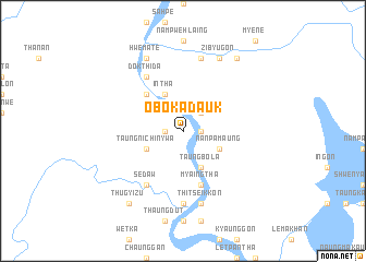
Obokadauk (Sagaing, Myanmar)Obokadauk is a town in the Sagaing region of Myanmar. An overview map of the region around Obokadauk is displayed below.
regional and 3d topo map of Obokadauk, Myanmar ::
Obokadauk airports ::
The nearest airport is IMF - Imphal, located 87.3 km west of Obokadauk.
Other airports nearby include IXS - Silchar (181.2 km west), AJL - Aizwal Aizawl (212.4 km south west), Nearby towns ::
Natset (1.7km east) //
Saingkun (1.7km west) //
Tayawzeik (2.5km north east) //
Linmu (2.5km north east) //
Nanpamaung (3.8km south east) //
Intha (4.1km north west) //
Taungbola (4.1km south east) //
Taungni-chinywa (3.8km south west) //
Tonhe (5.0km north west) //
Myaingtha (5.8km south) //
Sedaw (6.5km south west) //
Peinhnegon (6.5km north west) //
Dokthida (6.5km north west) //
Nanthanyit (7.4km south) //
Namhpanwaik (7.6km north) //
Thitseikkon (7.6km south) //
Zibyugon (8.1km north east) //
Hwemate (8.1km north west) //
Tabaw (8.1km north west) //
Namhkam (9.0km north east) //
Thugyizu (9.0km south west) //
Nantat (9.0km south west) //
[all distances 'as the bird flies' and approximate] 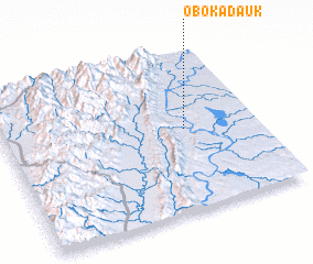 Places with similar names to Obokadauk, Myanmar :: Disclaimer :: Information on this page comes without warranty of any kind |
||
|
Where is Obokadauk? Elevation and coordinates ::
Latitude (lat): 24°31'0"N Longitude (lon): 94°43'0"E
Elevation (approx.): 116m (map arrows pan, magnifying glasses zoom) |
||
|
Visiting Obokadauk? Hotel/Accommodation ::
Book a hotel in Obokadauk Travel Guide ::
Buy a travel guide for Myanmar rental cars ::
car rental offers GPS waypoint ::
download a GPX waypoint (PoI) of Obokadauk for your GPS receiver
|
||