|
search place name
|
||
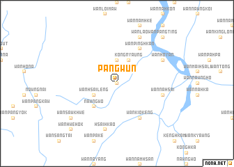
Pangwun (Shan, Myanmar)Pangwun is a town in the Shan region of Myanmar. An overview map of the region around Pangwun is displayed below.
regional and 3d topo map of Pangwun, Myanmar ::
Pangwun airports ::
The nearest airport is MOG - Mong Hsat, located 110.1 km south east of Pangwun.
Other airports nearby include KET - Kengtung (130.3 km east), HEH - Heho (171.8 km west), THL - Tachilek Tachileik (173.8 km south east), LSH - Lashio (218.4 km north), Nearby towns ::
Wān Nā-mon (0.0km north) //
Wān Nawnghkam (1.9km north) //
Wān Nā-kawk (3.7km north) //
Kongnyaung (4.1km north east) //
Wān Hsai-leng (3.9km south west) //
Nawngwo (5.1km south west) //
Wān Pinghkan (6.5km north east) //
Wān Kio-keng (6.5km south east) //
Wān Nā-hsai (7.2km east) //
Wān Namhu (7.6km south) //
Hsai-hkao (7.6km south) //
Wān Lao (8.2km north east) //
Wān Ho-yan (7.8km north east) //
Wān Sawkhwe (8.9km south west) //
Wān Pangting (10.1km north east) //
Wān Hwè-hok (10.1km south west) //
[all distances 'as the bird flies' and approximate]  Places with similar names to Pangwun, Myanmar ::
// Pangwon (MM)
// Peinnekwin (MM)
// Pinkhwun (MM)
// Pongwun (MM)
// Pangawan (MY)
// Pancawuenu (ID)
// Ponokawan (ID)
// Pinocawan (PH)
// Pinokawan (PH)
// Pengwan (CN)
Disclaimer :: Information on this page comes without warranty of any kind |
||
|
Where is Pangwun? Elevation and coordinates ::
Latitude (lat): 21°6'0"N Longitude (lon): 98°24'0"E
Elevation (approx.): 541m (map arrows pan, magnifying glasses zoom) |
||
|
Visiting Pangwun? Hotel/Accommodation ::
Book a hotel in Pangwun Travel Guide ::
Buy a travel guide for Myanmar rental cars ::
car rental offers GPS waypoint ::
download a GPX waypoint (PoI) of Pangwun for your GPS receiver
|
||