|
search place name
|
||
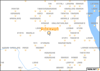
Pinkhwun (Shan, Myanmar)Pinkhwun is a town in the Shan region of Myanmar. An overview map of the region around Pinkhwun is displayed below.
regional and 3d topo map of Pinkhwun, Myanmar ::
Pinkhwun airports ::
The nearest airport is HEH - Heho, located 84.6 km north of Pinkhwun.
Other airports nearby include MDL - Mandalay Intl (208.6 km north west), Nearby towns ::
Peinnegon (2.5km north west) //
Loi-maung (3.9km north west) //
Htipaung (4.1km south west) //
Pinhkun (4.1km north west) //
Kawlin Htikalauk (5.1km north east) //
Htipyi (5.5km east) //
Mehkun Ywathit (5.8km north) //
Nampan (6.6km north west) //
Pinkyain Ywathit (6.6km north west) //
Nagabat (6.6km south west) //
Saungbyaung (6.4km south east) //
Yeyi (6.4km south west) //
Hsaungkhe (7.4km south) //
Maungla (7.0km west) //
Mehkun (7.4km north) //
Sindaung Taung (7.4km north) //
Tadauk (7.0km east) //
Lenbwa (7.2km east) //
Kwunsaung (7.6km north west) //
Wān Palo (7.6km north east) //
Konzi (8.2km north west) //
Ham-en (7.9km north east) //
Hti-mwun (9.1km north west) //
Tanhtek (9.1km north east) //
[all distances 'as the bird flies' and approximate] 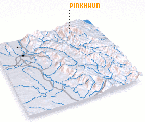 Places with similar names to Pinkhwun, Myanmar ::
// Pangwon (MM)
// Pangwun (MM)
// Peinnekwin (MM)
// Pongwun (MM)
// Pangawan (MY)
// Pancawuenu (ID)
// Ponokawan (ID)
// Pinocawan (PH)
// Pinokawan (PH)
// Pengwan (CN)
Disclaimer :: Information on this page comes without warranty of any kind |
||
|
Where is Pinkhwun? Elevation and coordinates ::
Latitude (lat): 19°59'0"N Longitude (lon): 96°48'0"E
Elevation (approx.): 1402m (map arrows pan, magnifying glasses zoom) |
||
|
Visiting Pinkhwun? Hotel/Accommodation ::
Book a hotel in Pinkhwun Travel Guide ::
Buy a travel guide for Myanmar rental cars ::
car rental offers GPS waypoint ::
download a GPX waypoint (PoI) of Pinkhwun for your GPS receiver
|
||