|
search place name
|
||
Pun (Mandalay, Myanmar)Pun is a town in the Mandalay region of Myanmar. An overview map of the region around Pun is displayed below.
regional and 3d topo map of Pun, Myanmar ::

Pun airports ::
The nearest airport is MDL - Mandalay Intl, located 122.0 km north east of Pun.
Other airports nearby include HEH - Heho (188.1 km east), KYP - Kyaukpyu (238.6 km south west), Nearby towns ::
Konpaya-nyaungbingan (1.9km north) //
Chaukkan (1.9km north) //
Mayaukye-ngaliang (1.9km south) //
Taungzin (3.7km south) //
Natpalindangyin (3.9km south west) //
Taungkwin (5.1km north west) //
Magyizauk (5.6km south) //
Kunywa (5.6km south) //
Kaungbinsi-myoma (5.8km south) //
Kangyikon (5.5km west) //
Zi-o (6.5km north east) //
Tawywa (6.5km south east) //
Panidwin (6.4km south east) //
Chaungshi (6.5km south west) //
Kuywa (6.5km north west) //
Mye-thindwin (7.6km north) //
Wagingyi (7.6km south) //
Thedwin (7.6km south) //
Kwebyok (7.6km south east) //
Wetlu (8.9km north east) //
[all distances 'as the bird flies' and approximate] 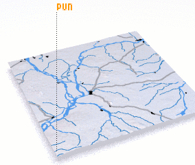 Places with similar names to Pun, Myanmar ::
Disclaimer :: Information on this page comes without warranty of any kind |
||
|
Where is Pun? Elevation and coordinates ::
Latitude (lat): 21°4'0"N Longitude (lon): 95°1'0"E
Elevation (approx.): 306m (map arrows pan, magnifying glasses zoom) |
||
|
Visiting Pun? Hotel/Accommodation ::
Book a hotel in Pun Travel Guide ::
Buy a travel guide for Myanmar rental cars ::
car rental offers GPS waypoint ::
download a GPX waypoint (PoI) of Pun for your GPS receiver
|
||