|
search place name
|
||
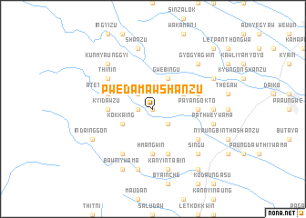
Pwèdamaw Shanzu (Myanmar)Pwèdamaw Shanzu is a town in Myanmar. An overview map of the region around Pwèdamaw Shanzu is displayed below.
regional and 3d topo map of Pwèdamaw Shanzu, Myanmar ::
Pwèdamaw Shanzu airports ::
The nearest airport is RGN - Yangon Intl, located 104.2 km south west of Pwèdamaw Shanzu.
Nearby towns ::
Nyaunggon (0.0km north) //
Pwèdamaw (1.8km west) //
Pwèdamaw Ywama (1.8km west) //
Pwèdamaw Ywathit (2.6km north west) //
Kangale (2.6km south east) //
Kokkaing (4.0km south west) //
Gwebingu (4.1km north east) //
Intazin (4.0km north east) //
Hmangwin (5.6km south) //
Kyidawzu (5.3km west) //
Payangokto (5.3km east) //
Atet Pwègale (5.6km west) //
Thè Kindan (5.6km east) //
Pyindaungdwin (5.8km south) //
Bawni Ywathit (6.6km south west) //
Thin-in (6.5km north west) //
Myaukohawgon (6.5km south east) //
Pathwè (7.1km east) //
Shanzu (7.6km north) //
Taung-inzu (7.6km south) //
Pathwè Ywama (7.3km east) //
Kanyintabin (7.6km south) //
Kunmyaunggyi (7.7km north west) //
Singu (7.7km south east) //
Gyogyagwin (7.7km north east) //
Indainggon (8.0km south west) //
Bawni Ywama (8.2km south west) //
Bawni (8.2km south west) //
Natsingon (8.0km north east) //
[all distances 'as the bird flies' and approximate] 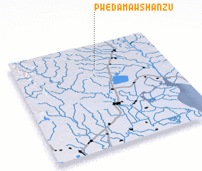 Places with similar names to Pwèdamaw Shanzu, Myanmar :: Disclaimer :: Information on this page comes without warranty of any kind |
||
|
Where is Pwèdamaw Shanzu? Elevation and coordinates ::
Latitude (lat): 17°46'0"N Longitude (lon): 96°32'0"E
Elevation (approx.): 25m (map arrows pan, magnifying glasses zoom) |
||
|
Visiting Pwèdamaw Shanzu? Hotel/Accommodation ::
Book a hotel in Pwèdamaw Shanzu Travel Guide ::
Buy a travel guide for Myanmar rental cars ::
car rental offers GPS waypoint ::
download a GPX waypoint (PoI) of Pwèdamaw Shanzu for your GPS receiver
|
||