|
search place name
|
||
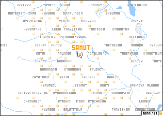
Samut (Myanmar)Samut is a town in Myanmar. An overview map of the region around Samut is displayed below.
regional and 3d topo map of Samut, Myanmar ::
Samut airports ::
The nearest airport is RGN - Yangon Intl, located 192.8 km south of Samut.
Nearby towns ::
Gwegyi (1.9km north) //
Kama (1.9km south) //
Tangon (1.9km south) //
Pandaw (2.6km south west) //
Kangale (2.6km south west) //
Myetnigwin (2.6km south west) //
Hlezwemyaung (2.6km south east) //
Paukkon (3.5km west) //
Peingyaw (3.7km north) //
Sinlu-aing (3.7km south) //
Ngazilaung (3.5km east) //
Kyeindawmyaung (4.1km north west) //
Domakhin (4.0km south west) //
Kyu-in Anauk (4.1km south west) //
Kyu-in Ashe (4.1km south west) //
Kyu-in (4.1km south west) //
Zalokkyi (5.1km south east) //
Gwegyo (5.6km south) //
Seikpugon (5.6km west) //
Khingyi (5.6km west) //
Thayettaw (5.8km north) //
Lālganj (5.8km south) //
Gonmin (6.4km north west) //
Patta (6.6km south west) //
Kinwaing (6.4km south west) //
Thategon (6.6km north east) //
Thitchaukkin (6.6km south east) //
Okpo (7.0km west) //
Lebyingyi (7.4km south) //
[all distances 'as the bird flies' and approximate]  Places with similar names to Samut, Myanmar ::
Disclaimer :: Information on this page comes without warranty of any kind |
||
|
Where is Samut? Elevation and coordinates ::
Latitude (lat): 18°37'0"N Longitude (lon): 96°29'0"E
Elevation (approx.): 28m (map arrows pan, magnifying glasses zoom) |
||
|
Visiting Samut? Hotel/Accommodation ::
Book a hotel in Samut Travel Guide ::
Buy a travel guide for Myanmar rental cars ::
car rental offers GPS waypoint ::
download a GPX waypoint (PoI) of Samut for your GPS receiver
|
||