|
search place name
|
||
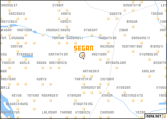
Segan (Myanmar)Segan is a town in Myanmar. An overview map of the region around Segan is displayed below.
regional and 3d topo map of Segan, Myanmar ::
Segan airports ::
The nearest airport is MDL - Mandalay Intl, located 152.6 km north east of Segan.
Other airports nearby include HEH - Heho (191.9 km east), KYP - Kyaukpyu (205.7 km south west), Nearby towns ::
Nyaunggyat (1.9km north) //
Lindagaing (1.9km north) //
Petthandaw (2.5km north west) //
Magyigan (3.5km east) //
Thanbo (3.7km south) //
Gwebingyi (4.1km north west) //
Wathesan (4.1km south east) //
Gwebingale (5.1km north west) //
Kanthitkon (5.2km west) //
Sanzu (5.2km east) //
Thayetpin (5.6km south) //
Awzadaw (5.5km east) //
Magyibinzu (5.5km west) //
Tongon (5.5km west) //
Kywedat (5.8km north) //
Thittogan (5.8km north) //
Sanni (6.6km north east) //
Sangan (6.6km north east) //
Tonywa (6.4km north west) //
Pebingon (6.4km north east) //
Teinsan (6.4km north west) //
Thabutkon (6.4km north east) //
Zigyobin (6.6km south east) //
Swebaukkan (6.6km south east) //
Pyaywa (6.6km north west) //
Thanbin (7.4km south) //
Ywama (7.2km west) //
Amyaunggan (7.2km east) //
Kinmungyon (7.6km south) //
[all distances 'as the bird flies' and approximate] 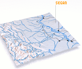 Places with similar names to Segan, Myanmar ::
Disclaimer :: Information on this page comes without warranty of any kind |
||
|
Where is Segan? Elevation and coordinates ::
Latitude (lat): 20°43'0"N Longitude (lon): 94°57'0"E
Elevation (approx.): 321m (map arrows pan, magnifying glasses zoom) |
||
|
Visiting Segan? Hotel/Accommodation ::
Book a hotel in Segan Travel Guide ::
Buy a travel guide for Myanmar rental cars ::
car rental offers GPS waypoint ::
download a GPX waypoint (PoI) of Segan for your GPS receiver
|
||